The Species We Lost
Costa Rica's deforestation didn't just destroy "forests." It erased reservoirs of endemic species, many still unknown to science. What was lost is permanently lost, and what regrew is genetically narrower.
National Geographic once called Corcovado National Park "the most biologically intense place on Earth." Tour operators market it as a unique remnant of pristine wilderness. Scientists travel from around the world to study its remarkable biodiversity. But there is something uncomfortable at the core of this narrative: Corcovado isn't special. The forest there is the same forest that once covered the entire Pacific lowlands of southern Costa Rica. What makes Corcovado "unique" today is simply that it was too remote and too rugged to clear. The species we celebrate there are refugees from a much larger ecosystem that was destroyed everywhere it could be reached.
In 1943, the United Fruit Company surveyed the Osa Peninsula for banana cultivation. The soils, topography, and accessibility were unsuitable. The company conceded defeat and transferred more than 47,000 hectares to one of its retiring engineers. That accident of agricultural unsuitability is why Corcovado exists today.
One Ecosystem
The forests cleared during the 20th century were not interchangeable. Costa Rica contains at least 12 distinct Holdridge life zones, each with characteristic species assemblages shaped by elevation, rainfall, and temperature. The Pacific lowland wet forest that once extended from Quepos to Panama is ecologically distinct from the Caribbean slope rainforest, the cloud forests of the central highlands, or the dry forests of Guanacaste.
The Talamanca mountain range, uplifted approximately 3 million years ago by subduction of the Cocos Ridge, serves as a giant barrier separating moist and wet lowland rainforest species. This vicariant separation has produced documented sister species pairs on the Caribbean and Pacific sides: the white-collared manakin on the Caribbean versus the orange-collared manakin on the Pacific; the Collared Aracari in Caribbean lowlands versus the Fiery-billed Aracari on the central and southern Pacific. Among dung beetles, vicariant pairs include Phanaeus beltianus and P. changdiazi. Populations of the frog Craugastor bransfordii from the Pacific versant are "markedly divergent" from Caribbean populations.
But vicariance only accounts for species that split into pairs across the divide. The Pacific lowlands also harbor species with no Caribbean counterpart at all — organisms that evolved entirely within the wet forests between Quepos and the Golfo Dulce, and exist nowhere else. These Pacific endemics had no backup population on the other side of the mountains, no sister species in another life zone. When their habitat was cleared, their entire range was cleared with it.
In 1940, approximately 75% of Costa Rica was forested. By the mid-1980s, that figure had fallen to around 21%. The rate of loss during the cattle boom years approached 4% annually, among the highest deforestation rates ever recorded anywhere in the world. The drivers were multiple: U.S. development agencies and the World Bank funded cattle ranching expansion; fast food chains created insatiable demand for cheap beef; Costa Rican land law granted property titles to those who "improved" their land by clearing forest. The law classified any land in its "natural state" as terreno inculto subject to special taxation. Landless campesinos pushed into the frontier, cutting trees to establish ownership.
The United Fruit Company's operations illustrate the scale. Beginning in the mid-1930s, the company established the Quepos Division in the valleys of the Parrita, Damas, Naranjo, and Savegre rivers, clearing 12,000 to 14,000 hectares. The Golfito Division, extending from the port of Golfito to the Panama border and northwest to Palmar, reached 24,000 hectares under cultivation by 1979. When the company arrived in 1937, the region was described as "primeval wilderness with almost no human habitation." Tough men came to fell thousands of giant trees with axes. By the time the railroad connecting Golfito to Palmar was completed in late 1940, the forest was gone.
The same forest that survives in Corcovado once extended across Valle del General, Uvita, Quepos, and Palmar Sur. Valle del General was colonized primarily in the 1940s-1950s, now dominated by pineapple plantations. Quepos-Parrita was cleared by United Fruit, now covered by African oil palm. Palmar Sur became a mix of palm plantations, agriculture, and settlement. Uvita and the central Pacific coast lost most of their forest to cattle ranching; former pastures have since been recovering as secondary forest. The real estate boom is now reversing that recovery, with housing, hotels, and ocean-view subdivisions clearing the land a second time. These places hosted the same Pacific lowland wet forest ecosystem as Corcovado. Survival came down to range geometry: whether a species' distribution happened to include the Osa Peninsula, the steep Fila Costeña ridges, or another patch of terrain too rugged to clear. A species restricted to the Valle del General had no surviving habitat to fall back on.
The Survivors
The Osa Peninsula is one of the most intensively studied tropical forests in the world. Researchers have worked there for decades. Even the Amazon cannot match its density of tree species. The broader Brunca region hosts over 1,000 documented tree species; the Osa alone contains approximately 750, about 80 of which are endemic and 23 endangered or threatened. Approximately 4.8% of tree species are endemic to the Osa and adjacent mainland. Over 300 endemic species of plants and vertebrates survive on the peninsula.
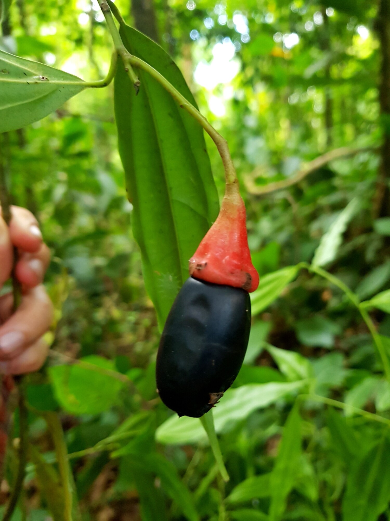
The endemic species we know about provide evidence for the ones we don't. Some local guides claim that fully 20% of trees in Corcovado have not yet been classified by science. While almost certainly an overstatement, even conservative scientific estimates suggest the gap in our knowledge is substantial: globally, researchers estimate that 10-14% of all tree species remain undiscovered, concentrated in tropical forests. In comparable Amazonian plots, approximately 30% of trees remain as "morphospecies" without formal scientific names. On the Osa, botanist Reinaldo Aguilar has personally discovered 15 new tree species since 1991. Between 1990 and 2005, scientists described 57 new plant species from the peninsula, 52 of them endemic. New species continue to be found: Hymenaea osanigraseminae in 2018, Prioria peninsulae in 2022. Consider some of the trees that survive in the fragments of Pacific lowland wet forest:
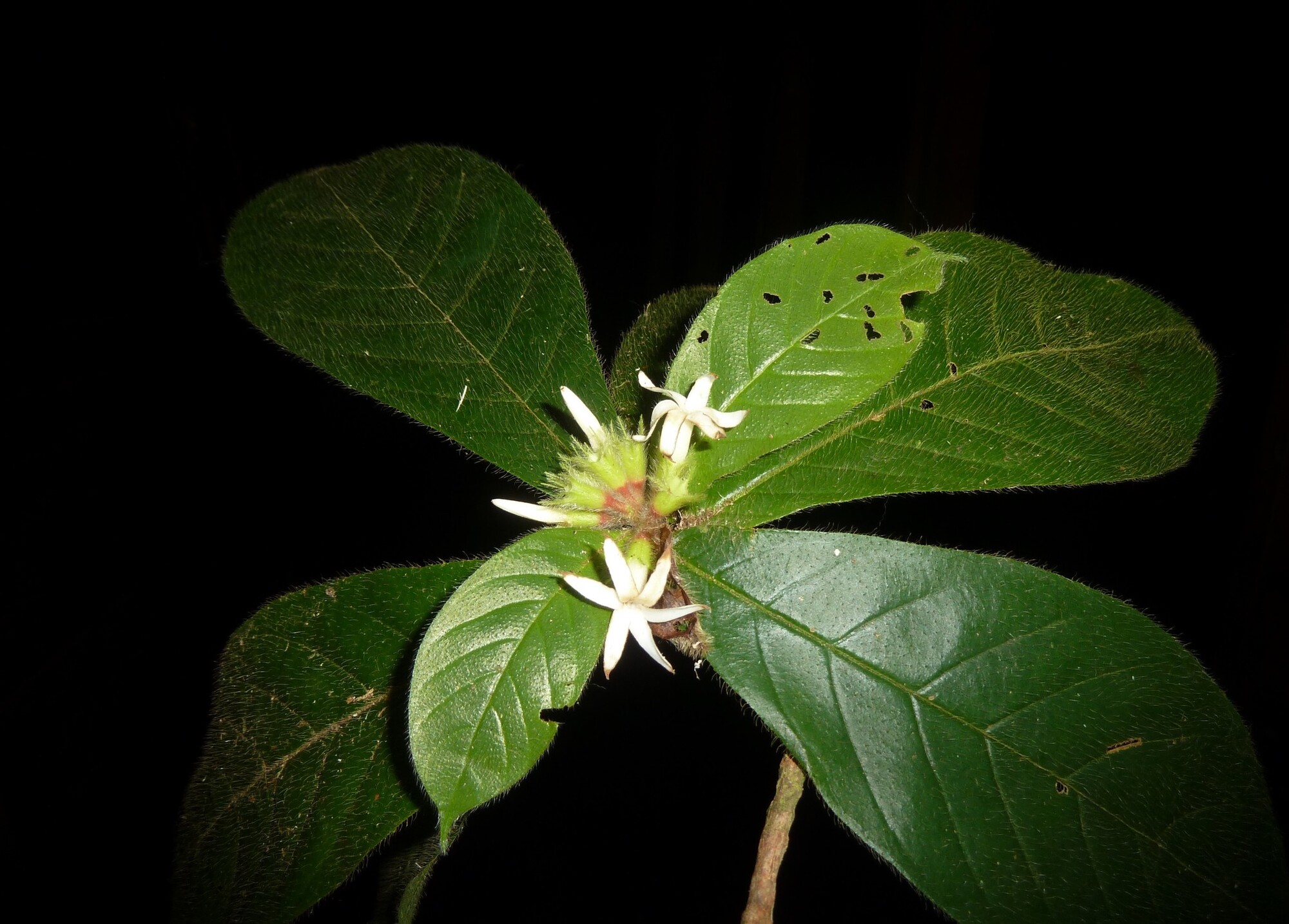
- Duroia costaricensis: An understory tree endemic to the Golfo Dulce lowlands. GBIF records show approximately 240 occurrences, all concentrated in the Brunca region. This species exists nowhere else on Earth.
- Alibertia utleyorum: Listed as Vulnerable by the IUCN, nearly endemic to the Osa Peninsula, with only 57 known occurrences. Most individuals occur in Corcovado.
- Prioria peninsulae: Described only in 2022. For decades, botanists collecting in the Pacific lowlands identified these massive canopy trees as P. copaifera, the Caribbean species. Reinaldo Aguilar and colleagues discovered it was a distinct species, endemic to the ridges and slopes of the Osa Peninsula and Piedras Blancas.
- Aiouea obscura: A member of the avocado family described in 1988, found solely on steep slopes of evergreen lowland rainforest southeast of Palmar Norte. Classified as Vulnerable due to habitat loss.
- Ocotea patula: Described in 1999, this small Lauraceae is known only from Cerro Anguciana in the Fila Costeña, roughly 30 kilometers inland from Dominical. No fruits have ever been collected. The species remains so poorly known that it has not yet been assessed by the IUCN.
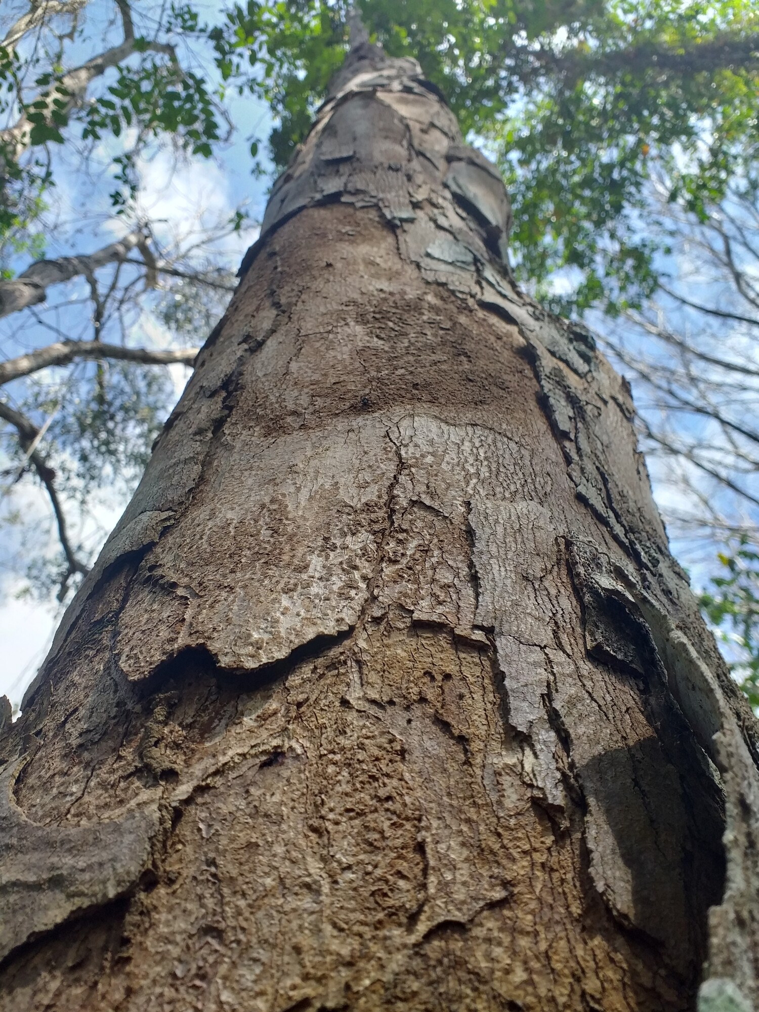
- Paramachaerium gruberi: An impressive tree reaching 45 meters in height, endemic to Costa Rica and Panama, found only in the Fila Carbonera area of the southern Osa Peninsula and near Puerto Armuelles, Panama. A 2007 forest survey (Castillo et al.) found only 12 mature individuals.
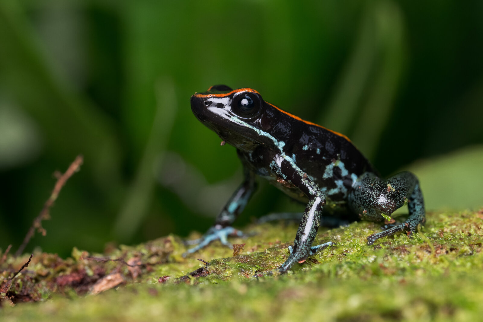
Beyond trees, the Pacific lowland wet forest harbors species found nowhere else. The Black-cheeked Ant-Tanager (Habia atrimaxillaris) is endemic exclusively to the Osa Peninsula and adjacent forests along the eastern shore of Golfo Dulce. Baird's Trogon (Trogon bairdii) occurs only on the Pacific slope from the Tarcoles River south into western Panama. The Central American Squirrel Monkey (Saimiri oerstedii) is restricted to the Pacific wet lowlands, the only squirrel monkey species outside South America. The Golfo Dulce Poison Dart Frog (Phyllobates vittatus) is endemic to the Osa Peninsula and Golfo Dulce region. Nine freshwater fish species are found only on the Osa.
A cruel irony of Costa Rica's deforestation is that systematic botanical collecting in the Pacific lowlands occurred simultaneously with destruction, not before it. Henri Pittier and Adolphe Tonduz conducted the first systematic botanical surveys from 1887 to 1904, but their focus was primarily on the Central Valley. Paul H. Allen served as botanist for the United Fruit Company at the Esquinas Experimental Station from 1948 to 1953, one of the few collectors specifically working in the southern Pacific lowlands during the early clearing period. His 1956 book The Rain Forests of Golfo Dulce provided the first systematic inventory of the region, cataloguing more than 1,300 species in 134 families. The forest swept, he wrote, "almost unbroken from the coastal swamps of Coto and Sierpe to the crests of the highest hills." He identified a group of tree genera with no Caribbean equivalents: Peltogyne, Vantanea, Huberodendron, Raphia, whose nearest relatives were Amazonian, connecting these Pacific forests to South American lineages. The Raphia palm swamps behind Jalaca Farm and near the Laguna de Sierpe were, he noted, "the only known occurrence of the genus on the Pacific coast of Central America." Even as he compiled these records, the clearing was accelerating. Of the General Valley to the north, he observed: "Forest stands are being destroyed just as rapidly as people can get to them. Many invaluable stands are felled for catch crops of rice or corn worth only a fraction of the market price of the lumber destroyed." Alexander Skutch established his farm Los Cusingos in the Valle del General in 1941. His 78-hectare refuge is now one of the last fragments of what the valley originally looked like.
This pace of discovery in Corcovado, the best-studied remnant of Pacific lowland wet forest, raises an obvious question: if we are still finding new species there, what existed in the areas cleared before anyone could survey them? How many Duroia species, how many Aiouea species, how many organisms at every taxonomic level, existed only in the Valle del General or the forests around Palmar Sur? We will never know. They were eliminated before they were discovered.
The Genetic Narrowing
Even where the same species survives, what survives is narrower than what existed. A landmark 1998 study in Science examined Symphonia globulifera, a tree pollinated by hummingbirds and dispersed by bats and birds, in fragmented forest in southern Costa Rica. The researchers used genetic analysis to trace parentage of seedlings found in forest fragments. The results were striking: 68% of seedlings in forest fragments were produced by pasture trees (isolated remnant trees standing in cleared land), and 77% of those seedlings came from only two trees. A severe genetic bottleneck was funneling the next generation through a tiny number of parents.
A 2005 study in Science examined Iriartea deltoidea, a canopy palm, in a 24-year-old secondary forest at La Selva Biological Station. The researchers found an extreme founder effect: only two out of 66 old-growth forest trees contributed 56% of the genes to the founding population of palms in the secondary forest. A 2007 follow-up in Ecology documented something even more concerning: genetic diversity was progressively declining across generations. Adults had more diversity than saplings, which had more diversity than seedlings. The genetic inheritance was narrowing with each generation.
The consequences extend beyond diversity metrics. A study of Samanea saman found that while genetic diversity in isolated trees was comparable to trees in continuous populations, seeds from isolated trees had lower germination rates, produced smaller leaves, and generated less biomass. The trees looked healthy, but their offspring were weaker. This is inbreeding depression in action: reduced fitness in the progeny of genetically impoverished parents.
Researchers call this the "fragmentation genetics paradox": adult trees in fragments often retain high genetic diversity because they established before fragmentation occurred. But the diversity is not being passed to the next generation. It is like a reservoir slowly draining while showing a full waterline. The adults look fine. The seedlings tell a different story. Scientists describe this as a "genetic extinction debt": the consequences of fragmentation are coming due, but on a timescale that disguises the severity.
The Fragments Are Still Degrading
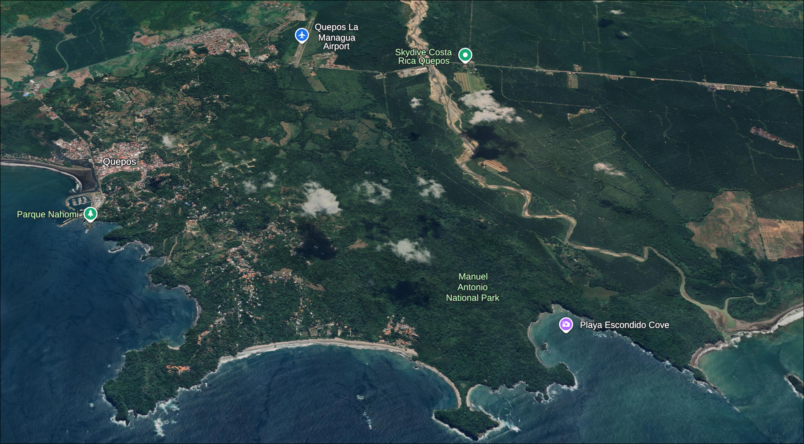
Manuel Antonio National Park illustrates what happens when a forest fragment becomes isolated. The park is a small remnant of Pacific lowland forest surrounded by a sea of palm plantations, hotels, and development. A 2012 study in Landscape Ecology documented its predicament: while some forest regeneration occurred between 1985 and 2008, the park is "rapidly becoming isolated" due to the expansion of oil palm plantations adjacent to it and throughout the lowland areas. Local communities reported perceived decreases in wildlife abundance and compositional change, attributing this primarily to illegal hunting. The primate populations that draw tourists may be deceptively abundant: when forests are cleared, mobile animals flee to the nearest remaining habitat. The individuals we see may be refugees from surrounding areas that were destroyed, not indicators of a healthy population.
A 2017 study in PLOS ONE examined what happens inside a protected forest fragment over time. Researchers surveyed a 2.25-hectare plot in a 365-hectare mid-elevation forest fragment at the Las Cruces Biological Station, isolated since the mid-1970s. The plot was located in the center of old-growth forest, more than 400 meters from the nearest edge. Although the fragment maintained high species richness (more than 200 tree species), the researchers documented a strong shift in composition. Pioneer species had doubled in abundance. Meanwhile, the dominant late-successional understory tree and most species in the Lauraceae family (the avocados and their relatives, critical food sources for quetzals and other fruit-eating birds) declined dramatically. Mean tree diameter decreased significantly. Overall biomass dropped by 10%. The forest was shifting from a mature, complex community toward something younger and simpler. The researchers called this a "species composition degradation debt" coming due some 40 years after fragment isolation.
This is the extinction debt: fragments look species-rich immediately after isolation, then decline over decades as the debt comes due. Even with protection, even far from the edge, the forest is changing. Fragments without protection, fragments closer to edges, fragments surrounded by active agriculture, will be changing faster.
The genetic research explains why connectivity matters. The La Selva study found that secondary forest palms within 400 meters of old-growth received genes from outside the study area, maintaining diversity. Palms farther from old-growth showed progressive genetic erosion across generations. The old-growth fragments are the source of genetic diversity, but secondary forests are the corridors through which that diversity flows. Cut the corridors, and you isolate the fragments. Isolate the fragments, and the genetic extinction debt comes due.
Secondary forests also accumulate biodiversity over time. Research published in Proceedings of the National Academy of Sciences found that secondary tropical forests can recover approximately 75% of tree diversity within 30-50 years. Given enough time and connectivity to old-growth sources, secondary forests provide habitat for displaced wildlife, food sources for seed dispersers, and stepping stones for species moving between fragments. Each decade of growth adds complexity, structure, and species. Clearing a 30-year-old secondary forest for a hotel or a subdivision does not just remove "degraded" land. It resets a biological clock that had been running for three decades and severs a connection that isolated fragments desperately need.
The Survivors Are Still Under Threat
Costa Rica's recovery to approximately 60% forest coverage represents a genuine conservation success. But this recovery does not undo the extinctions that occurred during the collapse. It does not restore the genetic diversity within surviving species. It does not recreate the organisms that were eliminated before they were discovered.
The Fila Costeña, the coastal mountain ridge running parallel to the Pacific, escaped the worst of the cattle boom. Its steep terrain made clearing difficult. Portions retain primary forest. These ridges became refuges for species displaced from the valleys below. But the refuge is now under assault from both sides. The inland slope facing Pérez Zeledón has been significantly stripped by agriculture. The coastal slope is being cut into for luxury foreign development: vacation homes, boutique hotels, ocean-view subdivisions.
When a developer clears a ridgetop lot on the Fila Costeña, they are not clearing "empty forest." They are cutting into refugee populations. The trees on that ridge may include species that once ranged across the entire Pacific lowlands but now survive only in these fragments. The Aiouea on that steep slope, the Duroia in that ravine, may represent a significant fraction of the remaining individuals of their species. Each clearance is a roll of the dice. We do not know what we are eliminating because we have not finished cataloguing what survives.
This is why protection of remaining old-growth is not a separate goal from the secondary recovery underway across the Pacific slope: it is its precondition. Corcovado, Piedras Blancas, the forests around Golfo Dulce, the fragments on the Fila Costeña: these are not just "protected areas" or "undeveloped land." They are the last repositories of evolutionary information from an ecosystem that once covered a much larger territory. The secondary forests growing back since the 1990s are drawing their species from these pockets; the genetic diversity accumulating in those recovering forests is only as rich as what survives here. Every hectare cleared removes something that cannot be replaced. What escaped the cattle boom may not escape the real estate boom.
The secondary forests growing across the Pacific slope are three to four decades into a recovery that takes centuries. The species moving into them are coming from the pockets that survived: Corcovado, Piedras Blancas, the fragments on the Fila Costeña. Further clearing of those pockets cuts the supply. Further clearing of the recovering secondary forest resets the clock. The biodiversity this region is known for has not recovered. It is recovering, slowly, from a damaged baseline, dependent on source populations that are themselves under active development pressure. The only thing required to let that process continue is to stop interrupting it.
Resources & Further Reading
Scientific Studies
Aldrich & Hamrick (1998) in Science documenting the genetic bottleneck in Symphonia globulifera, where 77% of forest fragment seedlings came from just two pasture trees.
Sezen et al. (2005) in Science documenting extreme founder effects where two old-growth trees contributed 56% of genes to a secondary forest palm population.
Broadbent et al. (2012) in Landscape Ecology documenting the growing isolation of Manuel Antonio National Park and perceived wildlife declines.
Zahawi et al. (2017) in PLOS ONE documenting compositional shifts and biomass loss in a protected Costa Rican forest fragment.
PLOS ONE (2015) documenting 71.6% forest loss in the Las Cruces region from 1947-2014, with over 90% occurring between 1947-1980.
Endemic Species Profiles
Profile of an endemic species with approximately 240 known occurrences, all in the Brunca region.
A massive canopy tree endemic to the Osa Peninsula, recognized as distinct from its Caribbean sister species only in 2022.
Nearly endemic to the Osa Peninsula with only 57 known occurrences, most in Corcovado National Park.
Background Reading
The full history of Costa Rica's deforestation and recovery, from 75% coverage in 1940 to 21% in the 1980s to 60% today.
An exploration of forest succession, biodiversity recovery, and why secondary forests differ from old-growth.
STAPFIA (2008) documenting the history of the Golfito Division, from forest clearing in the late 1930s through closure in 1985.
The political and environmental history of Costa Rica's conservation movement. Documents how the mejoras doctrine embedded deforestation into law and credit systems, and how the national parks system emerged from within the same era.
David Kaimowitz (CIFOR, 1996). Analyzes the economic and institutional drivers of cattle ranching expansion across Central America, including how the mejoras system — where clearing was legally recognized as improvement — shaped land tenure and land prices.