Roots in the Tide
Mangroves cover about a tenth of a percent of the world's land, and from that sliver they feed coastal fisheries, take the force out of storm waves, and store several times more carbon per hectare than an inland forest. On International Mangrove Day: what they are, where the great ones stand, and what is happening to the single Pacific coast that holds 99.85 percent of Costa Rica's.
On 26 July 1998, on the estuary at Muisne on the Pacific coast of Ecuador, a crowd went out to pull apart a shrimp pond. The pond had been dug illegally into the mangrove, and the local NGO FUNDECOL and Greenpeace had brought people together to break its walls and replant the site. During the action Hayhow Daniel Nanoto died; the Mangrove Action Project's retrospective account names him as a Greenpeace activist from Micronesia and gives the cause as a heart attack. Latin American mangrove groups took 26 July as a day for the mangroves in his memory. Redmanglar, the regional network constituted at Choluteca in 2001, adopted the date as well. The Mangrove Action Project traces the day's international spread to a 2003 workshop at Fortaleza in Brazil. Redmanglar made the formal international declaration at its Second General Assembly in 2004. In 2015 the General Conference of UNESCO adopted 26 July as the International Day for the Conservation of the Mangrove Ecosystem.
The fight at Muisne was over a strip of trees that barely shows on a map. Globally, mangroves cover about 147,000 square kilometres, or 14.7 million hectares, in 123 nations and territories by UNEP's count: a tenth of a percent of the world's land. In 2024 the first global assessment of mangroves for the IUCN Red List of Ecosystems found half of the world's mangrove ecosystems at risk of collapse by 2050.

Trees that live in salt water
"A mangrove" means two different things at two different scales: the coastal forest, or any one of the trees that build it. The different tree species we know as "mangrove" come from different families. Unrelated lineages made the move into salt water separately, something like fifteen to twenty-seven times over depending on where botanists draw the line, though many species alive today descend from one of those crossings rather than making it themselves. Nearly all of them live across the tropics and subtropics, roughly between 30 degrees north and 30 degrees south. Every one of those crossings had to get past the same three obstacles to end up rooted in salt water, on a shore the tide floods and drains twice a day on most coasts.
Salt is the first obstacle. Most plants cannot tolerate salt, because of osmosis: water moves toward the saltier side, so soil water saltier than the sap in a root pulls water out of the plant instead of feeding it in. A plant standing in seawater dies of thirst. One old story has you salting your enemy's field to starve them out. If that field happens to be waterlogged and your neighbour has an appetite for mangroves, the joke's on you. Botanists sort mangroves into secretors, which take the salt up and then shed it, and non-secretors, which keep most of it out at the root. That split is functional rather than taxonomic, and it cuts across families. Red mangroves in the genus Rhizophora are non-secretors: Smithsonian Ocean puts their exclusion at more than 90 percent of the salt in the water they draw in. Black mangroves in the genus Avicennia are secretors, sweating it out through glands on their leaves, which are often crusted white with salt crystals. Storage is a further route. Some mangroves hold in the leaves what the glands do not shed, and those leaves thicken as they age and carry the salt off the tree when they fall.
Air is the second obstacle. Roots need oxygen: a tree makes its energy by photosynthesis, but it has to spend that energy through respiration, which consumes oxygen the way an animal's breathing does. Most trees take that oxygen from the gas held between soil particles. Waterlogged mud holds almost none, so mangroves take their air above the waterline instead. Avicennia, Laguncularia and Sonneratia push pneumatophores (breathing roots) up out of the mud in the thousands, some pencil-thin and some shaped like cones, and draw air in through pores called lenticels along their surface. A red mangrove arches prop roots out of the trunk to hold itself clear of the tide, and Bruguiera loops knee roots up out of the mud and back down again. The forms differ. In each of them, some part of the root system stays in the air.
Getting a seedling started at all is the third obstacle. Salt is a problem again at germination, and a seed that germinates still has to find a foothold in water that is moving. Mangrove seeds are evolved to handle both jobs, and they do it in two ways. A red mangrove practises true vivipary: the seed germinates on the tree and hangs there, a long green seedling, before it drops, ready to plant itself in the mud where it falls or float off to root elsewhere. Black and white mangroves practise cryptovivipary, where the embryo germinates inside the fruit while the fruit is still attached, and the fruit falls before the root has broken out of it. Either way the seedling leaves the parent already growing. The trees sort themselves along the shore by how much salt and flooding each can bear, so a mangrove grows in bands, pioneers standing in the water and other species behind them.
There are only about 70 true mangrove species, and most of them grow in the Indo-Pacific. The count is soft, because the line is ecological rather than taxonomic. A true mangrove carries the adaptations for living in the tide, while a mangrove associate hugs the upper edge of the forest without them, and botanists differ over where to draw the line. On the American coasts the list is short, chiefly the red, the black, the white (Laguncularia racemosa), and the buttonwood (Conocarpus erectus), which most authorities count as an associate. Costa Rica has seven species from four families. The red, the black and the white range widest, growing on both Costa Rican coasts and on both sides of the tropical Atlantic. Avicennia bicolor is confined to the eastern Pacific, from Chiapas in Mexico down to western Colombia, and most records of it come from Costa Rica and Panama. The tea mangrove, Pelliciera rhizophorae, stops partway up the Pacific: its continuous range ends around the Gulf of Nicoya, and north of that it survives only in a few scattered Guanacaste stands, among them the protected mangrove at Potrero Grande. That is five. The other two are a second red, Rhizophora racemosa, and the buttonwood, which some counts admit and others leave out.
All three of those adaptations are expensive, and none of them is a reason to live in the sea. Mangroves do not need salt. Several grow better in fresh water in the laboratory. Daniel Simberloff, writing the mangrove entry in Janzen's Costa Rican Natural History, set the puzzle down and left it there: why, then, are they restricted to seacoasts, and not found in fresh water or on high land? The likeliest answer is that tolerating salt buys a place where almost nothing else can follow. Ball and Pidsley grew two related Sonneratia side by side across a range of salinities. One of them handled full seawater; the other gave out at half that strength. In the brackish water where both grew best, the salt-tolerant species came out half the height of its weaker relative, with half the leaf area and half the biomass. Salt tolerance costs growth, and a slow tree is beaten inland by faster ones. On the shore it has almost nothing to beat. Against the seventy-odd trees that live in the tide, more than 10,000 species grow at the freshwater edge of the land.
The tide pays them back twice over. It keeps the ground itself alive. At Estero Tortuga on the Osa coast the estuary lost its tidal flow. Researchers marked 273 seedlings there and watched every one of them die inside a year, while the old trees died back and inland plants moved in. And the tide carries the seed. In one global model the floating seedlings average 715 kilometres over six months, and the longest crossing on record ran more than 10,000 kilometres. The best a tree manages on dry land, by getting an animal to eat its fruit and carry the seed off, is a median of 245 metres.

What a mangrove is worth
What a mangrove is worth has been counted five ways: as a fishery, as a sea wall, as a carbon store, as a trap for what the rivers carry down, and as habitat. The fishery is the most direct of them. Sponges, oysters, barnacles and anemones settle on the hard surface of the roots, and the tangle between them is a hiding place for anything small enough to use it. Crabs, shrimp and fish spend the early part of their lives in there before moving out to open water as adults, which is why mangroves are counted as nursery habitat. A Goliath grouper stays until it is a metre long, about six years, and only then leaves for the reef. A 2025 model estimates that the world's mangroves support more than 700 billion juvenile fish and invertebrates a year. A 2008 study in the Gulf of California found mangrove-related fish and crab species accounting for 32 percent of small-scale fishery landings there, with a median annual value of 37,500 dollars for every hectare of mangrove fringe. Mangroves support about 126 million fishing days a year. The same IUCN 2024 assessment that put half the world's mangroves at risk projects a loss of 17 million of those fishing days a year by 2050, about one day in seven, as climate change and rising seas take and drown the forests behind them.
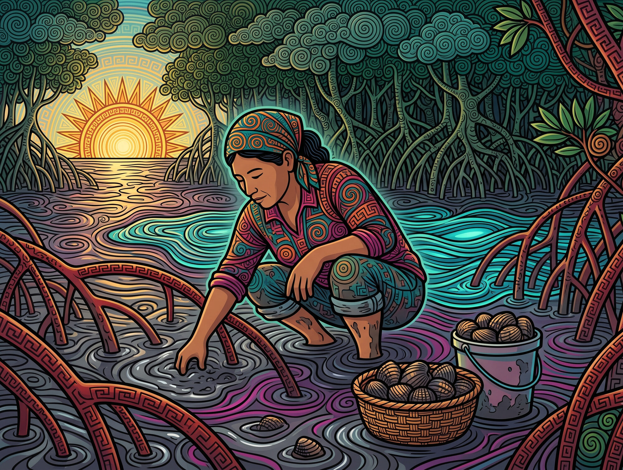
In the Pacific mangroves of Costa Rica, harvesters called piangüeros dig by hand for the piangua (Anadara tuberculosa and A. similis), in the estuarine towns of the Térraba-Sierpe wetland and around the Gulf of Nicoya. A 2004 Estado de la Nación estimate put the whole Pacific piangua fishery at roughly 1,000 harvesters, four in ten of them women. The same report found that half the piangua sold in the country comes from the Gulf of Nicoya. The 2024 study of the Chacarita mangrove at Puntarenas found seven in ten of the cockles pulled up below the 47-millimetre legal minimum, a size fixed by decree in 1982 and, on that evidence, largely unenforced.
As a sea wall, a belt of mangrove about 100 metres wide cuts wave height by 13 to 66 percent, and slows storm surge as it passes through. A 2020 study led by Pelayo Menéndez and Iñigo Losada estimated that mangroves prevent more than 65 billion dollars in coastal flood damage every year, and that losing them would put 15 million more people in the water. A mangrove stops water coming in from the sea, and only partly stops water coming down from the land. Researchers modelled the Guayas delta in Ecuador through an El Niño in which the sea and the rivers rose together. They found the mangroves flattened the sea's share of the peak and left the river's share untouched. Peak levels were still up to about 20 centimetres lower with the mangroves in place, but that came from damping the ordinary tide rather than the flood.
Mangroves are among the most carbon-dense forests in the tropics, storing on the order of 1,000 tonnes of carbon per hectare, several times what an upland tropical forest holds. Most of it is locked in deep waterlogged soil, where the lack of oxygen slows the rot of dead roots and leaves to a crawl. Mangroves hold significant amounts of carbon above ground too. In Costa Rica, a 2012 survey measured the above-ground carbon in the mangroves at Gandoca and Estero Moín, on the Caribbean coast, and found more of it than in Costa Rican primary forest.
Mangroves also function as a filter. The rivers bring down sediment and fertiliser, and a mangrove slows the water enough to keep some of each. Sediment arriving on the rising tide settles among the roots where the current goes slack, and the ebb is too weak to lift it again. In one Indian estuary the belt where Avicennia and Rhizophora grow together held back 30 percent of what the tide carried in. In two Indian mangroves, up to 99 percent of the nitrate that disappeared from the water was converted to ammonium and held in the sediment rather than vented to the air as gas. The mud does that work, not the trees, and what the mud holds it can also give back. At Térraba-Sierpe, researchers from the Tecnológico sampled the Sierpe River every month through 2018. Nitrate climbed from a baseline near 5 milligrams per litre to 20 once the surrounding oil palm and rice were fertilised, then fell again as the river ran down to its mouth. The Tecnológico team read that downstream drop as the wetland still stripping nitrate out of the water. The same paper records what park staff were seeing in the months after each fertilisation, aquatic plants blooming and mangrove reproduction dropping off. Across 57 wetlands worldwide most cut the nutrient load passing through them, but one in eight sent out more than came in, and net export turned up more often the longer and more closely a wetland was measured.
A mangrove holds very few kinds of tree and a great many kinds of animal. The prop roots put hard surface into soft mud, which almost nothing else on a muddy shore does. The tide then runs the forest in two shifts. Fish come in on the high water to feed, and birds work the flats the ebb lays bare. Gilbert Barrantes surveyed a 200-hectare mangrove at Chomes, on the Gulf of Nicoya, eight days out of every fortnight from July 1986 to December 1987. He recorded 111 bird species there, 79 of them resident. Sixty-seven of the residents were land birds, and 37 of those bred in the mangrove: eighteen at its edge, eight in its interior, eleven in both. On the mudflat beside that forest, Barrantes and Ana Pereira counted shorebirds and gulls (Charadriiformes) and found 27 species. Those birds feed out on the mud rather than among the trees, and some of them roost in the mangrove behind. American crocodiles, spectacled caimans and roseate spoonbills also live in Costa Rican mangroves, and capuchins, howlers and squirrel monkeys pass through them, though SINAC notes that few mammals stay permanently.
Hardly any mangrove animal lives in mangrove and nowhere else. A 2009 review counted just 69 terrestrial vertebrates worldwide that appear restricted to mangroves, 48 of them birds, with the whole group concentrated in Asia and Australia. The mangroves of Trinidad hold 84 bird species, of which exactly one is confined to mangrove. Costa Rica's one such bird is the mangrove hummingbird, endemic to the Pacific coast mainly between the Gulf of Nicoya and Golfo Dulce. BirdLife and the IUCN list it Endangered, with a population of 1,500 to 7,000 mature birds, and it feeds mainly at the flowers of the tea mangrove.
Where the great mangroves stand
The largest mangrove on earth is the Sundarbans, 10,000 square kilometres straddling the India-Bangladesh border where the Ganges, Brahmaputra and Meghna meet the sea. It is the only mangrove forest that holds tigers, about 100 of them on the Indian side, swimming the channels and taking deer, boar, even fish and crabs. The whole forest averages 2 metres above sea level. A 2010 study projected a 28-centimetre rise above 2000 levels within 50 to 90 years, and calculated that it would cost the tiger 96 percent of its habitat in Bangladesh. A study that later modelled tiger habitat put the loss higher than 96 percent: no habitat at all left suitable by 2070.
Indonesia holds more mangrove than any other country, 3.4 million hectares, a fifth of the world's total on FAO's count. Nearly half of that lies in Papua. Indonesian mangrove also stores close to a quarter of the carbon held in the world's mangroves, a larger share than it holds of the area. The country is also losing mangrove, at about 18,000 hectares a year. Shrimp ponds still take the largest share, but agriculture, almost all of it oil palm, took 19 percent of the loss between 2009 and 2019. In Bintuni Bay in Papua, one concession covers 82,120 hectares of mangrove, logged on rotation for wood chips and sold into the Asian pulp and paper market.
The longest continuous mangrove belt on earth runs along the Amazon-influenced coast of Pará and Maranhão in Brazil, about 650 kilometres in a straight line and 7,200 square kilometres of forest. It runs from Marajó Bay to the Preguiças estuary, with one break of about 8 kilometres at Baía de Cumã. Part of why it survives is that almost nobody lives there: 8 percent of Pará's population is coastal, against up to 40 percent in other Brazilian states. Tides of 4 to 7.5 metres flood the forest twice a day, and the mangrove itself runs more than 40 kilometres inland up the estuaries. Those same tides hold the soil carbon at about half the global mangrove average. Mangrove soil keeps its carbon only while the water keeps the ground airless, and where a big tide drains it twice a day, the authors suggest, air gets in and less carbon stays. People work the belt too. In March 2024, after sixteen years of petitioning, Brazil declared two more extractive reserves there, 74,700 hectares on which 7,000 fishing families hold the legal right to fish and harvest.
Africa's largest mangrove is the Niger Delta. Nigeria held 8,442 square kilometres of mangrove in 2020, nearly three times what the next African country holds and fifth largest of any country in the world. It is also the most oil-damaged mangrove on earth. Nigeria's spill agency has logged some 18,000 confirmed spills since 2006, and more than a third of those records carry no estimate of how much oil came out. The largest documented event was at Bodo, where two spills in 2008 and 2009 ran for 149 days between them and put 82.9 million litres into the creeks. Obida and colleagues read satellite images a decade later and found 393 square kilometres of dead vegetation around Bodo, most of it mangrove, with no sign of recovery. One study attributes 54 percent of the delta's mangrove loss to oil. The rest goes to dredging, to cutting for fuelwood, and to nipa palm. That Asian palm was planted at Calabar in 1906, and it takes the bare ground the oil and the dredgers leave and holds it.
Up the same Ecuadorian coast from Muisne, where this article began, in the Cayapas-Mataje reserve, stood the trees long billed as the tallest mangroves in the world. Two ministry documents disagree about how tall they were. An official field guide puts the Majagual stand, the tall grove inside the reserve, at 30 metres or more; a later management plan puts it at about 63. The two trees that made the reserve famous, reported at 65 and 63.8 metres, fell within months of each other in 2005. A laser hypsometer has since put the tallest mangrove in the Americas at 57 metres, a red mangrove at Iscuandé in Nariño, about 190 kilometres up the same coast in Colombia. A satellite map published in early 2025 ranks Colombia's mangroves tallest of any country's by canopy height.
On Florida's Atlantic coast the mangrove has been filling in the northern end of the range it has long occupied. Between 29 and 29.75 degrees north, roughly Daytona Beach to just short of St. Augustine, its area doubled from 1984 to 2011. Hard freezes had kept it out, and they have grown rarer. Mean winter temperature rose at seven of the eight coastal weather stations, but that rise does not match where the mangrove spread. The measure that does is the count of days colder than minus 4 degrees Celsius. At Daytona Beach there were 1.4 fewer such days a year in 2006 to 2011 than in 1984 to 1989. At Miami Beach, over the same two periods, it did not fall at all. The boundary has moved both ways before, flipping between salt marsh and mangrove at least six times since the late 1700s. One freeze in January 2018 damaged 60 percent of 38 monitored sites across the North American range edge.
In the austral summer of 2015-16, mangrove died across 7,400 hectares of Australia's Gulf of Carpentaria. That was about 6 percent of the forest in the affected stretch, which ran from the Roper River in the Northern Territory east to Karumba in Queensland. The shoreline was intact in early November 2015, visibly thinning by early December, and largely gone by January. That summer was an El Niño season of extreme heat, and the nine months to October 2015 were the driest since the record began in 1971. The team that mapped the dieback now ranks the falling sea ahead of the heat and the drought. Water levels fell about 0.4 metres for six months and stayed down through the dry season. The trees at the landward edge, no longer reached by the tide, died of thirst. Ten years on the recovery is patchy, and the team expects it to take decades.
Costa Rica's mangroves are one stretch of a Pacific coast that carries mangrove from Guatemala down to Panama, and Costa Rica is not the largest holder on that coast. One satellite survey put Panama's mangrove area at more than four times Costa Rica's. North of Costa Rica, the Gulf of Fonseca holds about 75,000 hectares, split 62 percent to Honduras, 32 percent to Nicaragua and 6 percent to El Salvador. The International Court of Justice ruled in 1992 that the three countries hold the gulf itself in joint sovereignty. The oceanographer Omar Lizano compared the Fonseca stands with Costa Rica's and found Fonseca's trees to be shorter, with some Avicennia there growing under half a metre.
The trees along this coast are split into populations that barely mix from one estuary to the next. Genetic work across the eastern Pacific finds strong structure between stands: the floating seedlings travel, but rarely far enough to blend one estuary's trees into the next one's. Animals move where the trees cannot. Sea turtles nest on open sand, but in the eastern Pacific the hawksbill lays predominantly inside mangrove estuaries, something it does nowhere else in the species' global range. Its three largest nesting colonies are all on this shore, at Estero Padre Ramos and Aserradores in Nicaragua and at Bahía de Jiquilisco in El Salvador.

Costa Rica, coast by coast
Costa Rica's first national mangrove map, published by SINAC and partners in 2023 with 2021 data, put the country's mangrove at 52,802 hectares. 99.85 percent of it is on the Pacific coast and 0.15 percent on the Caribbean. That one coast holds roughly a third of a percent of the world's mangrove. The national map and the global one are not measured the same way, and SINAC's total includes 13 percent canals and lagoons, which the satellite habitat-extent maps do not count. Nothing earlier was measured the same way, so the figure cannot show a trend. The one internally consistent satellite record, Global Mangrove Watch, has Costa Rica's mangrove barely moving: 393 square kilometres today, about 39,300 hectares, up 2.8 square kilometres since 1985. FAO's country series shows a decline, from 63,400 hectares in 1980 to 41,800 in 2000, and the two records overlap for fifteen years without agreeing. FAO's series is a trend line fitted through national estimates of very different quality, half of which sit between 39,000 and 41,300 hectares; the 1980 peak rests largely on a single 1979 survey well above every estimate around it.
Costa Rica's largest mangrove wetland is the Humedal Nacional Térraba-Sierpe, on the southern Pacific coast in the Osa region. The Ramsar-listed site covers 30,654 hectares where the Térraba and Sierpe rivers empty into the sea. A 2018 study working from 2012 satellite imagery puts roughly 14,800 of those hectares under mangrove. Its channels hold 55 species of fish by the Ramsar sheet. North of Térraba-Sierpe lies the Gulf of Nicoya. A 2018 SINAC estimate puts nearly 20,000 hectares of mangrove there, and earlier surveys put the fringe at 112 kilometres of shoreline. The gulf feeds one of Costa Rica's most important artisanal fisheries. On the other coast, at the Panama border, Gandoca-Manzanillo is the one Caribbean stand recognised as a true mangrove forest, dominated by red mangrove. The other Caribbean patches, such as Estero Moín, are freshwater swamp forest dominated by Pterocarpus officinalis rather than true mangrove.

What is taking them
Between 2000 and 2016 the rate at which people were clearing mangroves outright fell by 73 percent. In the late twentieth century mangroves had been disappearing at least as fast as rainforests or reefs. The clearing has not stopped, though: human activity still drove 62 percent of the loss between 2000 and 2016, and the single largest cause was commodities, the shrimp ponds, rice fields, and oil-palm plantations that replace a mangrove. Human-driven loss is concentrated in Southeast Asia, and nearly 80 percent of it came from six countries, Indonesia, Myanmar, Malaysia, the Philippines, Thailand and Vietnam.
The other threat is the sea, and unlike the ponds it is still gaining. A mangrove keeps pace with rising water by trapping sediment and packing its dead roots and leaves into the soil, building the ground upward; when the water climbs faster than the mud, the forest drowns. A study of 78 sites from the last great deglacial sea-level rise, 10,000 to 7,500 years ago, found that mangroves very likely cannot keep up once the sea rises past 6.1 millimetres a year. Tropical coastlines are on track to cross that line by 2050 under high-emissions scenarios. Often the forest cannot move inland at all: the shore behind it is already built on, and it is squeezed against the rising water.
Costa Rica is losing mangrove to both, one by inches and one by the truckload. At Térraba-Sierpe the mangrove is being starved of mud. As the sea rises it strips away the fine mud the mangrove grows on, and upstream the river no longer brings down enough mud to replace it. A UCR researcher links the loss of dry-season flow in the Térraba to pineapple expansion upstream. An ecologist interviewed for the same report points to water concessions concentrated upstream, drawn on hardest in the dry season. "El manglar de Sierpe se está quemando," said the oceanographer Omar Lizano. The Sierpe mangrove is burning. He means a forest dying back as the ground under it turns from fine mud to coarse sand. The fast loss shows up on the Nicoya coast at Sámara, where the mangrove of Río Lagarto was cleared away over decades and then buried under construction fill, truckload by truckload; the fill is visible in aerial imagery from 1996 onward. In 2024 the Constitutional Chamber gave SINAC twelve months to study the site and deliver a definitive solution. Nearly two years on, La Voz de Guanacaste reported that none of the fill had been hauled out, and SINAC's Área de Conservación Tempisque said removing it costs more than the institution can afford.

Protected, mostly on paper
Since 1971 the Ramsar Convention has committed the countries that join it to conserve wetlands of international importance, and mangroves fall inside its definition. More recently the Global Mangrove Alliance has set targets for 2030: halt the loss, restore half of what can be brought back, and double the area under protection. Roughly 42 percent of the world's mangroves now sit inside protected areas. Only about 13.5 percent sit in the strictest protection categories, IUCN I to IV.
Costa Rica protects its mangroves about as firmly as law allows. They are public domain and part of the Patrimonio Natural del Estado, the State's Natural Patrimony. Article 11 of the maritime-zone law, Ley 6043, covers every mangrove, "whatever its extent." It places them in the strictest public tier: land that as a rule cannot be titled, leased, or occupied. The forestry law bars logging in mangroves, and it bars the forestry administration from granting new permits over them. The courts have upheld those rules. A 2020 Constitutional Chamber ruling set out the wetland-protection regime the mangroves sit inside. A 2024 decision struck down a decree that had shrunk the Tivives protective zone, a central Pacific reserve that includes a mangrove.
In 2022 the Contraloría General de la República found the State's protection of mangroves outside the formal protected areas ineffective. Where a case does get filed, it can outlast the building that caused it. At playa Matapalo in Guanacaste, an 8,233-square-metre mangrove was filled during construction of the Hotel Riu. The environmental tribunal finally ordered the mangrove restored in November 2025, sixteen years after the original complaint. Eight months on, the order has still not taken effect, and nothing can be done until it does. Riu's appeal and a ruling on precautionary measures are both undecided at a tribunal that reported more than 4,560 files in process and only three sitting judges. In July 2026 the Constitutional Chamber took up a new constitutional appeal over the delay.
Bringing a mangrove back
Mangrove restoration projects exist all over the tropics, and the oldest of them are now decades old, long enough to show what works. Most projects plant seedlings. In the Philippines, long-term survival of planted mangroves runs 10 to 20 percent. A 35-million-dollar World Bank fisheries programme in the Central Visayas put in nearly 3 million seedlings between 1984 and 1992; an evaluation cited by the ecologist Roy Lewis found 18.4 percent of them alive. Kodikara and colleagues found regrowth on only about a fifth of the area Sri Lanka planted after the tsunami. Kodikara puts the spending at about 13 million dollars. The reasons repeat: seedlings pushed into water too deep, into ground where mangroves never grew, or the wrong species planted in the wrong zone. Repairing the tides usually beats planting seedlings. Working in Tampa Bay, Lewis found that mangroves do best with their roots wet about 30 percent of the time and dry the other 70. The job, he argued, is to rebuild that rhythm rather than the forest. Give the tide a slope it can climb and the floating seeds arrive on their own. At West Lake Park near Fort Lauderdale he moved the soil, cut the slope, and planted nothing at all; within a decade all three of Florida's mangrove species had established themselves. Smithsonian Ocean credits his method with bringing forests back in more than 20 countries. Only a handful of hydrological projects have been studied against the many planted ones, so the comparison is not settled. The spending is not waiting for that comparison. The Global Mangrove Alliance helped design the Mangrove Breakthrough, a four-billion-dollar programme aimed at 15 million hectares by 2030.
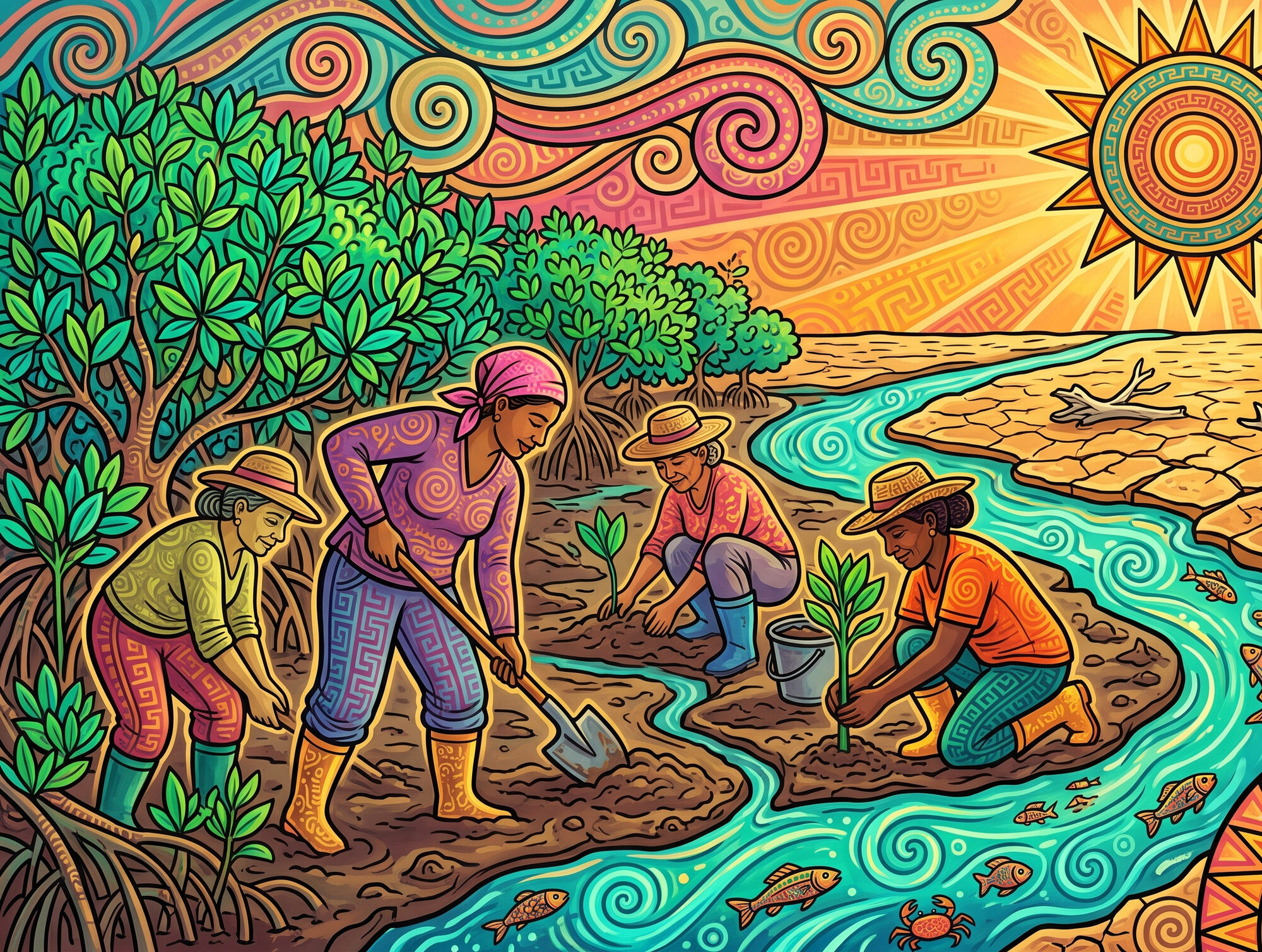
In Guanacaste a similar repair was done by hand. At Bahía Tomás, near Cuajiniquil, a salt operation had killed off a stretch of mangrove decades ago and left a salt crust that the Área de Conservación Guanacaste put at up to 15 centimetres, through which nothing could grow. From about 2018, a local women's cooperative, working with the conservation area, got the tidal channels dug back open by hand, pura pala, to flush the salt out, and planted where they had to. By 2023 the conservation area reported the crust down to millimetres, salt-tolerant white mangrove recolonising, and the crabs back in the channels. The women belong to the Cooperativa de Mujeres de Cuajiniquil, which has since set up a food truck alongside the restoration site.
So, Happy World Mangrove Day to you. Mangroves are hugely important and unique forest ecosystems that deserve our protection. Please consider sharing this article to help raise awareness.
Resources & Further Reading
Global status and International Mangrove Day
Landing page and full report. Source for the ~15 million hectare global figure and the fall in loss rates. The three goals (halt loss, restore half, double protection) and the ~42% protected share are on the alliance's About Us page; note the word "2030" does not appear there, and the 2030 horizon is confirmed instead by IUCN's 2022 account. Global Mangrove Watch's mapping counts more countries and territories than the 123 nations and territories UNEP counts.
The "50% at risk of collapse by 2050" and "33% threatened by climate change" headline findings, and the 2050 carbon, flood-protection, and fishing-effort projections. The 17-million-days figure is attributed by IUCN to climate change and sea-level rise specifically, not to mangrove loss generally. IUCN words the fishing bullet two ways, and only one of them is right. This press release reads "14% of current fishing effort is supported by mangroves"; the findings page reads "14% of current fishing effort supported by mangroves," meaning the 17 million days are 14 percent of the 126 million fishing days mangroves support. The arithmetic settles it (17 ÷ 126 = 13.5%), as do the sibling bullets, which give every loss as a share of the current total: 2.1 million lives is "14.5% of current lives exposed," $36 billion is "35.7% of current property values protected." The article follows the findings page. The 50% counts mangrove ecosystem units, the 36 provinces delineated for the assessment, which IUCN's own findings page notes also represent 50% of the world's mangrove area.
The movement's own retrospective account of the origin of the date: the 26 July 1998 action at Muisne, Ecuador, and the death of Hayhow Daniel Nanoto. Written eight years after the event, and distinct from UNESCO's 2015 proclamation.
Contemporaneous 1998 report of the FUNDECOL and Greenpeace protest at the illegal shrimp farm near Muisne.
Contemporaneous record that Redmanglar was constituted at Choluteca, Honduras, in August 2001, three years after the Muisne action.
The formal observance, first held in 2016, adopted by UNESCO's General Conference in November 2015. Secondary sources give the proclamation as document 38 C/66 of 6 November 2015, at Ecuador's request, but that document could not be opened to confirm it: unesdoc blocks automated access and the archived copy is a stub.
Source for FAO's 14.8 million-hectare global baseline for 2020, and for the finding that the rate of loss has slowed over the last decade. The newsroom item also cites 123 countries, but relays that figure from UNEP and hyperlinks it there; FAO's own report gives no count of mangrove countries at all.
The primary record behind the ~147,000 km² global extent: 147,359 km² of mangrove in 2020, down 5,245 km² from 1996.
The origin of the 123 figure: UNEP counts 123 nations and territories, and FAO's newsroom relays it from here. Also an independent source for the ~1,000 t C/ha carbon density, which pairs with Donato so that figure does not rest on one paper on two hosts. The live page blocks automated access; an archived copy is on the Wayback Machine.
Contemporaneous record that the proclamation was adopted in November 2015 by the General Conference of UNESCO, and that 26 July 2016 was the first observance.
The Mangrove Action Project's fuller account of the date's origin, including the "In the Hands of the Fishers" workshop at Fortaleza, Brazil, in early 2003 that produced the international call to action. Note that the movement's own sources date the first observance variously to 1998 and to 2000.
Independent Ecuadorian account of the 26 July 1998 death of Hayhow Daniel Nanoto during the replanting of mangrove razed by an illegal shrimp farm at Muisne, Esmeraldas. It calls him an environmental activist from Micronesia and gives no cause of death; the Greenpeace affiliation and the heart attack come from the Mangrove Action Project's retrospective account.
The four-billion-dollar, 15-million-hectare, 2030 initiative, established at COP27 as part of the Sharm El-Sheikh Adaptation Agenda and co-designed with the Global Mangrove Alliance and the High-Level Climate Champions; its Secretariat is hosted at Ambition Loop. All three figures were still the stated targets when checked in July 2026.
What a mangrove is
Reviewed by mangrove ecologist Candy Feller. General reference for the salt-secretor and salt-excluder strategies, pneumatophores and prop roots, and vivipary, and the source of the "over 90 percent" salt-exclusion figure for Rhizophora, which no second source could be found to corroborate: the ~90 percent figure in Scientific Reports 20426 is bound to Bruguiera, not Rhizophora. This page also states that buttonwood is a mangrove associate rather than a true mangrove, and gives the latitudinal band as 25°N-25°S rather than the 30° the article uses. Also the source, with BirdLife, for the mangrove hummingbird feeding preferentially on Pelliciera rhizophorae nectar. Note the live page blocks automated access (HTTP 403); it reads normally in a browser.
The IUCN assessment of all 70 true mangrove species; source for the species count and for Indo-Pacific richness.
The standing site-by-site review of Costa Rica's north Pacific mangroves, and the record of the healthy Pelliciera rhizophorae population at Manglar de Potrero Grande, Guanacaste. Potrero Grande was long taken to be the species' northern limit; later work has pushed it further north (see Loría-Naranjo et al. below).
The study that pushed the tea mangrove's known northern limit past Potrero Grande to Santa Elena Bay: "this study extends its distribution further north for the Pacific coast of Costa Rica."
First record of Pelliciera rhizophorae at Nandamojo, a further Guanacaste stand north of the Gulf of Nicoya.
Survey of four Gulf of Nicoya mangroves that counts seven nuclear species and names the four plant families of Costa Rica's mangroves in its own title.
Confirms that Avicennia pneumatophores are the pencil-like form (as against the conical Sonneratia type), and that a single 2-3 m Avicennia marina tree usually carries more than 10,000 of them. The count is bound in the entry to A. marina specifically, not to Avicennia generally, which is why the article says only "in the thousands."
Agency reference binding the red, black and white common names to their species, and describing how they band along the shore from waterline inland.
The source for the 30°N-30°S band the article uses: "prior studies… geographically position mangroves within approximately 30° North and 30° South latitude." Smithsonian Ocean gives 25° for the same thing, and the true poleward limits reach 32°N and 38°S, so the band is an envelope rather than a hard line.
Reviewed reference for zonation driven by inundation duration and salinity ("These different requirements result in complex zonation patterns," with the caveat that they "are not universal"), for mangrove species being taxonomically unrelated, and for the buttonwood being "not really a mangrove species, but a transitional species between mangrove and terrestrial vegetation."
States plainly that the buttonwood, "although not a true mangrove, is still an important tree in these communities". It is one of four authorities, with Smithsonian Ocean, Coastal Wiki and the US Army Corps, that class Conocarpus erectus as a mangrove associate. Note that Polidoro et al. (2010), the source of the article's "about 70" count, does include it among the 70.
Why the article says "on most coasts": two tides a day is the common pattern but not a universal one. "Some areas, such as the Gulf of Mexico, have only one high and one low tide each day."
The literature assigns vivipary three functions, not one: protecting fragile propagules, long-distance sea dispersal, and "efficient seedling establishment" in a habitat "subject to high salinity, tidal waves, and unstable soil." The salinity-avoidance function is the one most often stated, which is why the article names salt at germination alongside the foothold in moving water.
The definition the article uses for the second germination strategy: "Some species, such as those in the genera Aegiceras, Avicennia, Nypa and Pelliciera, have developed cryptovivipary, in which the embryo emerges from the seed but not from the fruit until after the fruit abscises." FAO's list names the black mangrove; the white, Laguncularia racemosa, is placed in the same group by FAO's own silviculture literature. The report is also the source for Indonesia holding 21 percent of world mangrove area, which is why the article says a fifth rather than the quarter often quoted, and for the 14.8-million-hectare global baseline.
The cleanest measurement of what salt tolerance costs, and the experiment the article's competition paragraph turns on. Grown side by side, the more salt-tolerant S. alba ran from fresh water to full seawater; the less tolerant S. lanceolata stopped at half seawater. At 5 percent seawater, where both grew best, the less tolerant species reached twice the height, leaf area and biomass of the other. The authors conclude that "increasing salt-tolerance is at the expense of growth and competitive ability under low salinity conditions." Paywalled; the figures here are as quoted in Krauss et al. (2008) and Nguyen et al. (2015).
The standard Costa Rican reference, stating the article's question and declining to answer it: "Mangroves do not require salt; in the laboratory, in fact, several of them grow better in fresh water than in seawater (leading to the interesting question, beyond the scope of this introduction, of why mangroves are restricted to seacoasts and not found in fresh water or on high land)." Simberloff also relays Plutarch asking a version of the same thing around A.D. 70. Note that his remark that "why mangroves do not occur in temperate zones is unknown" was written in 1983 and has since been largely answered by the freeze literature this article cites for Florida.
Source for the contrast that makes the habitat's emptiness the point: "Globally, no more than 80 tree species have succeeded in invading intertidal zones to become mangroves, compared to over 10,000 that are found at the land-water interface in non-saline systems." The article states that contrast using its own figure of about 70 rather than Xu's 80, so that one piece does not carry two totals for the same thing. The two differ because each author draws the true-mangrove line in a slightly different place, which is the same reason the count of independent invasions of the intertidal ranges from about 15 to 27 across the published literature.
Source for the 715 kilometres: nearly 22 million modelled particles from 11,989 sites over five years give a mean travelled distance rising from 55 km at 10 days of propagule duration to 715 km at 180 days, with a maximum single connectivity event of 10,583 km. These are modelled figures and the tail does the work. Field observation runs the other way: Sousa et al. found Avicennia and Rhizophora propagules "seldom found more than 10 m from their release points." Both are true of the same fat-tailed kernel, and the article says modelled for that reason. The 245-metre terrestrial comparison is from Thomson et al. (2011), a 211-species synthesis of median dispersal distance by syndrome.
The Costa Rican counter-example, and the reason the article credits the tide rather than the salt. Estero Tortuga takes 4,954 mm of rain a year and its water table averages 1.5 g/L, below what the authors expect of a mangrove. Six plots holding 273 marked Rhizophora racemosa and Pelliciera rhizophorae seedlings had zero survivors after one year. The stand is all mature trees with almost no juveniles, Acrostichum fern reaches full ground cover in places, and R. racemosa over 15 m are dying with rotted roots. Having lost tidal influence, the site drops its propagules directly beneath the parents, and the authors read it as "una transición hacia un bosque continental."
What mangroves do: services and carbon
Source for the >US$65 billion/year flood-protection figure and the 15 million more people flooded if mangroves were lost.
Source for the 13-66% reduction in wave height over a 100-metre belt of mangrove. Hosted here at the TU Delft repository; the original conservationgateway.org PDF link no longer serves the document. The 100-metre figure belongs to wind and swell waves only: see the companion surge report below, which is the reason the article's lede speaks of a storm wave rather than a storm surge.
The companion report, and the reason the 100-metre figure cannot be applied to storm surge: "Measured rates of storm surge reduction through mangroves range from 5 to 50 centimetres water level reduction per kilometre of mangrove width," which the authors say "implies that a mangrove belt several kilometres wide is needed to significantly reduce storm surge water levels." Mangroves reduce surge "by slowing the flow of water"; the waves riding on top of a surge are what fall over much shorter distances.
Field and model evidence from Hurricane Wilma that South Florida's 6-to-30-kilometre-wide mangrove belt cut surge amplitude by 40-50 cm per kilometre: the independent primary study behind the kilometre-scale surge figures, and a useful corrective to the idea that a 100-metre belt is a general property of mangroves.
The document behind the widely quoted "95%" figure. It does not originate it: it relays the number from EPA's National Coastal Condition Report II (2004) as "95% of commercial fish … use coastal wetlands and estuarine habitats," and warns that the EPA percentages "cannot be directly compared" to its own. A U.S. estuarine statistic about coastal wetlands generally, not a mangrove-specific or species-level one.
The page that generalises the 95% figure from U.S. estuaries to coastal habitats worldwide: "Approximately 95 percent of all commercially important fish species depend on coastal habitats such as mangrove forests, coral reefs, seagrass meadows and saltmarshes, mud flats, and rocky shores at some point during their life." The page carries no citation or reference list of any kind. Traced back, the number originates in EPA's National Coastal Condition Report II (2004), which also states it without a citation; NOAA relays it and warns its own methodology is not comparable, and NOAA's analysis of 2000-2004 landings gives 46% by weight rather than 95%. The article does not use the figure. US mangrove is 266,179 ha, 98% of it in Florida, against 4.2 million acres of salt marsh, so a US coastal-wetlands statistic is overwhelmingly a salt-marsh statistic.
The ~1,023 t C/ha figure and the finding that mangroves store several times more carbon per hectare than upland tropical forest, most of it in soil.
Above-ground carbon of 153 and 119 Mg C/ha at the two Caribbean mangroves, exceeding published values for Costa Rican primary forest. Cite the Spanish abstract: those figures are exactly 0.464 × biomass, the standard Kauffman conversion factor, and preserve the Gandoca > Moín ordering. The English abstract prints 183 and 237 Mg C/ha, which invert that ordering and follow from no single conversion factor. Both abstracts agree the stocks exceed Costa Rican primary forest.
Costa Rican endemic, Endangered, confined to Pacific-coast mangroves from the Gulf of Nicoya (with outlying records north to Estero Tamarindo) south to Golfo Dulce. Albertazzi, Alvarado & Stiles (2024) moved the species from Amazilia to Chrysuronia. Note that the same 2024 paper describes it in passing as Near Threatened; that is an error. BirdLife and the IUCN have listed it Endangered continuously since 2000.
The full paper behind the ~1,023 Mg C/ha figure, including the soil-dominance percentages (71-98% of total storage at estuarine sites) and the comparison against the world's major forest domains. The paper scopes its superlative to "the tropics." The nature.com link above is abstract-only.
Independent confirmation that mangroves and coastal wetlands store three to five times more carbon per equivalent area than tropical forests, most of it in soil rather than above-ground biomass.
Source for mangrove nitrogen interception and long-term storage in dense soils: coastal wetlands trap nitrogen in root tissues before it seeps deeper into an estuary and causes dead zones.
Source for the 30 percent: at the Vellar estuary in southeast India, "Avicennia-Rhizophora interphase is much efficient by trapping at low tide 30% of total suspended sediment received at high tide." The paper carries its own dissent, which the article does not repeat: Woodroffe's view that mangroves "are a result, and not the cause of sedimentation in protected coastal areas." An Indian study published in a Costa Rican journal, not a Costa Rican measurement.
Why the article says nitrogen is held rather than removed: "up to 99% of nitrate removal in mangrove sediments is routed through dissimilatory nitrate reduction to ammonium (DNRA)… this mechanism effectively conserves and re-circulates N minimizing nutrient loss that would otherwise occur through denitrification." Two mangroves in Goa, India.
The Costa Rican record: a baseline "alrededor de 5 mg NO3-/L" without agriculture, peaks to 20 after fertilisation, and a decline downstream that the authors read as "la función aún activa del humedal y su importancia en el procesamiento de nitratos." Dilution appears in the paper only as an explanation for the smaller October peak, not for the seaward decline. The observed decline in mangrove reproduction is recorded as what park staff saw, not as measurement.
Source for the 57 wetlands and the one in eight: most reduced nutrient loading, "However, some wetlands increased nutrient loadings… Studies conducted over a period of a year or more, or that involved frequent sampling during high flow events, were more likely to indicate that the wetland increased nutrient loadings." Note the scope: wetlands generally, mostly Europe and North America, not mangroves specifically.
What is established about mangrove water purification and what is not. The review's services table lists purification as a function mangroves perform, through "nutrient and pollution uptake, as well as particle retention and deposition." What is missing is the price: "The economic value of the pollution control service of mangroves has not been reliably estimated," and the "estimates unavailable" entries sit in the valuation column, not the function column. The article describes the filtering and declines to put a number on it.
Source for the hard-substrate point and the Trinidad figures: mangrove roots "become home a rare feature: hard substrata in an otherwise soft sediment environment," and "Mangrove habitats in Surinam host 94 bird species, while in Trinidad these habitats support 84 bird species. Only one species, the rufous crab-hawk (Buteogallus aequinoctialis) is restricted there to mangrove habitats." Also the source for fish entering on the high tide to feed.
Source for the 69 and the 48: "Worldwide, a significant number of species are endemic to mangroves, including 48 birds, 14 reptiles, one amphibian, and six mammals, mostly in Asia and Australia." The underlying study is Luther & Greenberg (2009), BioScience 59(7), which is closed-access and was not read directly, so the figure is reported here from this restatement rather than quoted from source. The article does not claim the mangrove hummingbird is on that specific list.
Source for the Chomes mangrove counts: "During 18 months (July 1986 to December 1987) I visited for eight days every two weeks a mangrove area of 200 hectares in Chomes"; "I recorded 111 bird species in the study area. From these species, 79 were resident"; "Sixty seven out of the 79 resident species were terrestrial"; "Thirty seven of these 67 terrestrial species breed in the mangrove… Eighteen species reproduce at the mangrove edge, eight in the interior, and eleven in both parts." Note the paper's own Spanish abstract says "las 69 aves terrestres residentes" where the body says 67; the article follows the body, which gives the breakdown. This paper also states that Chomes was then the northern limit of the mangrove hummingbird, which later records at Estero Tamarindo and Playa Venado superseded, so the article does not repeat it.
Source for the 27 shorebird species: "We recorded 27 species of Charadriiformes on the mud flats of Chomes, Golfo de Nicoya, Costa Rica, during biweekly censuses over one year." A separate study from the mangrove one above, with a second author and its own fieldwork; the article keeps them apart rather than merging them into a single survey. The paper gives no area for the mudflat.
Why the article says shorebirds feed on the mudflat rather than among the trees: "Shorebirds usually forage on exposed tidal flats and they rarely use densely vegetated areas such as mangroves and saltmarsh, although a small number of shorebird species roost in mangroves." The same paper finds mangrove expansion reducing shorebird habitat at 8 of 14 sites by taking tidal flat, so mangrove and mudflat are not interchangeable for these birds.
Source for the 700 billion juvenile fish and invertebrates: "Application of our model globally estimates that mangroves support an annual abundance of over 700 billion juvenile fish and invertebrates."
Source for the 32 percent and the 37,500 dollars: "Mangrove-related fish and crab species account for 32% of the small-scale fisheries landings in the region. The annual economic median value of these fisheries is US $37,500 per hectare of mangrove fringe." Chosen over the widely quoted U.S. 95 percent figure because it is mangrove-specific and comes from the same Eastern Pacific small-scale fishery type as Nicoya and Térraba-Sierpe.
The reason this article carries no headline "X percent of fish depend on mangroves" figure. Sheaves traces the genre and finds it "imprecisely defined, and invariably cannot be traced back to definitive scientific data," warning that using "an indefensible pseudoscientific paradigm such as this to support conservation efforts, management actions and legal decisions, greatly weakens any arguments that build upon it."
Source for the limit on what a mangrove shelters against: "mangroves in the delta attenuate part of the oceanic contribution to the high water level anomalies… while mangroves have a negligible effect on the riverine component," because "the riverine discharge does not flow through mangrove-fringing channels upon arriving in the delta." Peak levels are still lower with mangroves present, by up to 22 cm in the El Niño riverine scenario and 21 cm under neutral conditions with no El Niño forcing at all. That the two are almost identical is the point: the reduction comes from damping the ordinary spring tide rather than the flood. No equivalent study exists for Costa Rica.
Where the great mangroves stand
Source for the Sundarbans as "the largest area of mangrove forest in the world and the only one that is inhabited by the tiger," and for tigers "capable of swimming for long distances and feeding on fish, crab and water monitor lizards." The separately nominated Bangladeshi property, The Sundarbans, supplies the Ganges-Brahmaputra-Meghna delta setting and calls it "the only mangrove habitat in the world for Panthera tigris tigris." Archived copies; the live pages block automated access.
The official source for the ~100 figure: 713 camera-trap stations across the Indian Sundarbans yielded 849 photographs "from which 100 individual tigers were identified," recorded as 101 (SE 10) for 2022. The dossier's older figure of about 76 tigers is superseded.
Peer-reviewed source for the prey list: "spotted deer Axis axis and wild pig Sus scrofa contributed a cumulative biomass of 89% to tiger diet." UNESCO supplies the fish and crab; between them the article's "deer, boar, even fish and crabs" is fully covered.
Source for Indonesia's ~3.4 million hectares and its share of the world total: "Spanning about 3.4 million hectares, Indonesia's mangroves account for over 20 percent of the global mangrove area." Estimates of the share run from 21 to 23 percent, so "close to a quarter" sits at the top of the published range. CIFOR supplies the Papua figure: Papua and West Papua hold roughly 10 percent of the world's mangroves, about half of Indonesia's.
The Honduran designation inside the gulf, and a caution against reading it as a mangrove measurement. Ramsar Site 1000 covers 75,031 hectares on the Honduran side, but it is a wetland system "consisting of seven areas" of mangrove, winter lagoons, marshes and sandy beaches, not a canopy survey. Its near-match to the 75,589 hectares the article gives for the whole gulf is coincidence: Honduras's entire national mangrove estate is 60,564 hectares on Global Mangrove Watch v3, so the Ramsar figure cannot be Honduran mangrove alone. Archived copy; the live RSIS host blocks automated access.
The origin of the 28 cm / 96% figure, and the reason the article no longer says later work "disputes" it. The paper puts the 28 cm rise 50 to 90 years out, and the 2070 horizon often attached to it comes from Kanan et al. (2023)'s summary, not from Loucks. Note that no later study restates the 96 percent on its own terms: Kanan and Payo model inundated land area rather than tiger habitat, and Mukul et al. (2019), the one later paper that does model the tiger, is harsher than Loucks, projecting "no remaining suitable Bengal tiger habitat in the Sundarbans" by 2070. Nor is the elevation data the deciding difference. Loucks worked from sub-metre data; Kanan's DEM is a 1991 FINNMAP survey at 50 m resolution whose 0.5 m uncertainty exceeds several of its own scenarios, and the authors note that no LiDAR survey of the area exists. The substantive methodological difference is that Loucks did not account for subsidence.
The peer-reviewed rebuttal, in the same journal, arguing the Loucks projection "seems too far in reality." Source for the article's 3.4 percent: "Results for the low (35 cm), mid (52 cm), high (70 cm), and extreme (147 cm) SLR scenarios indicate that the Sundarbans landmass area will be flooded up to 40 km2 (1%), 72 km2 (1.8%), 136 km2 (3.4%), and 918 km2 (23%), respectively." Read alongside Loucks, not instead of it, and note that it models land area rather than tiger habitat.
The only study after Loucks that models tiger habitat rather than inundated land, and the reason the article does not present the later literature as good news: "our model predicted that by 2070 there will be no remaining suitable Bengal tiger habitat in the Sundarbans." It also supplies the elevation critique that is often misattributed to the Loucks rebuttal, aimed at its own SRTM basis rather than at Loucks, who worked from sub-metre data.
Source for the Sundarbans' ~2 m mean elevation above sea level and its 10,200 km² extent across the India-Bangladesh border.
Peer-reviewed basis for the world's largest continuous mangrove belt on the Pará-Maranhão coast: "cerca de 650 km de litoral em linha reta," with a roughly 8 km break at Baía de Cumã, which is why the article says continuous rather than unbroken. The 7,200 km² of forest comes from a later RapidEye mapping, not from this paper.
The origin of the widely repeated "679 km" for the Pará-Maranhão belt, and the reason the article does not use it. The figure is not independent and not traceable: it appears here in October 2009 with no stated method, and nowhere in the originating science. Souza-Filho (2005), which makes the "largest continuous belt" claim, gives "cerca de 650 km de litoral em linha reta" instead, and that is the figure the article uses. The same paper records an ~8 km break at Cumã Bay, which is why the article says continuous rather than unbroken.
Source of the US$1 billion restoration fund and the "25 to 30 years" estimate, and of the finding that oil left mangrove roots coated in a bitumen-type layer a centimetre or more thick. Note the two figures are not the same thing: UNEP describes the billion as an "initial capital injection… to cover the first five years of the clean-up project," inside a recovery it estimates at 25 to 30 years.
The press write-up of O'Farrell et al. (2025). Read the underlying paper for the scope: what it measures is bare land, "increasing at a rate of 5644 hectares/year" across a study area of "just over 5200 km² of land… encompassing the coastal portion of Rivers State," over 2016-2024. That is a rate for one state's coast, not a delta-wide mangrove mortality figure, and the authors note that part of the bare-ground signal is "sulfidic dredged materials being dumped along the banks" rather than oil.
The remote-sensing analysis that places the world's tallest mangroves in Gabon, where stands attain 62.8 m. Reported heights for Majagual in Ecuador range from 45-50 m to 68 m depending on the source, none of them peer-reviewed. Ecuador's own ministry documents are no more consistent: the ECOLAP/MAE field guide gives 30 m or more, while the 2015 MAE management plan for the reserve gives about 63 m. Those two are the figures the article's sentence turns on.
Documents the doubling of mangrove extent between 29° and 29.75°N on Florida's Atlantic coast, driven by fewer days below −4 °C rather than by rising mean temperatures.
The ~1,000 km / ~7,400 ha Gulf of Carpentaria dieback and its drivers: the lowest recorded rainfall in the preceding nine months since 1971, and regional sea levels 20 cm below average.
Identifies the unprecedented sea-level drop as the crucial trigger, and notes that the maximum-temperature anomaly reversed sign at the peak of the event.
The country-by-country satellite table the article's national comparisons rest on. Its 2020 column gives Nigeria 8,442.43 km², fifth in the world behind Indonesia, Brazil, Australia and Mexico, and more than twice Mozambique's 3,027.35 km², the next African country. The same table carries Panama's four-to-one margin over Costa Rica, and Honduras's 60,564 hectares, which is what shows that Ramsar Site 1000 cannot be a measurement of Honduran mangrove alone. The publisher blocks automated access; the page reads normally in a browser.
Source for where Indonesia's mangrove carbon actually sits: "78 percent of carbon in mangrove systems in Indonesia is stored in the soil, 20 percent of carbon is stored in living trees, roots or biomass," which is why the article credits the soil rather than tree size. Note the widely repeated "one third" belongs to a different quantity: the page says Indonesia's 3.14 billion tonnes are "one third of global coastal carbon stocks," meaning all coastal ecosystems together. Indonesia's share of the world's mangrove carbon is a quarter, per Simard et al. (2019).
Source for the roughly 18,000 hectares a year and for the driver split: agriculture took 19 percent of the loss between 2009 and 2019, with "almost all of the converted area becoming oil palm plantations." The article uses this rather than the per-decade oil-palm shares in circulation, which no source states.
Independently confirms the 650-kilometre span, and is the direct source for how far the forest reaches inland: "mangroves can extend more than 40 km landward following the course of numerous small estuaries and bays." That is a measurement of the mangrove's own extent, not of how far salt water travels, which is why the article words it as the forest running inland. Archived copy; the live host was returning errors.
The published record of the two fallen giants: "two colossuses from the Majagual mangrove, of the Rhizophora variety (red mangrove) measuring 65 and 63.8 metres – have fallen, one nine months ago and the other four months ago." Published in March 2006 and citing C-CONDEM's February 2006 release, which places both falls in 2005. These are the two fallen trees, distinct from the 63.5 m standing tree reported elsewhere.
The later of the two ministry documents that disagree about Majagual's height, giving it at about 63 m against the field guide's 30 m or more. Also the source of the reserve's own coordinates for the Majagual stand, 1° 10' 16" N, 79° 05' 09" W, which is what puts Iscuandé about 190 kilometres away rather than 100.
The laser-hypsometer measurement behind the 57-metre red mangrove at Iscuandé in Nariño, the tallest mangrove measured in the Americas. Unlike the Majagual figures, this one was taken with an instrument and published in a peer-reviewed journal.
The canopy-height map that ranks Colombia first among countries, at a mean maximum of 46.1 m. Published 4 January 2025 from TanDEM-X acquisitions of 2011-2013, which is why the article dates it to early 2025 rather than 2024. The authors caution against reading the country table too closely: "Japan and Palau do not have mangrove forests reaching over 56 m… users should be wary of extreme values," and those two sit immediately above Ecuador in the ranking.
Source for the January 2018 freeze: "The 2018 freeze event affected 60% of the 38 sites." Those sites span three states on two coasts, and the 2018 damage was concentrated in Louisiana and the upper Texas coast, so the figure describes the North American range edge rather than Florida. The publisher blocks automated access; the page reads normally in a browser.
Source for the article's claim that the trees along this coast are split into populations that barely mix. The study finds strong genetic structure between eastern Pacific estuaries in both Rhizophora mangle and Avicennia germinans: propagules float, but rarely far enough or often enough to blend neighbouring stands. It is the counterpoint the hawksbill sentence turns on, since the turtle crosses gaps the trees do not.
Establishes mangrove-estuary nesting as a behaviour the hawksbill shows nowhere else in its range. NOAA records that eastern Pacific hawksbills nest "both on open sandy beaches and inside mangrove estuaries," which is why the article says predominantly rather than exclusively. Gaos et al. (2017) name the three largest rookeries as Estero Padre Ramos and Aserradores in Nicaragua and Bahía de Jiquilisco in El Salvador, all on this coast and none of them inside the Gulf of Fonseca.
Costa Rica: extent and the piangüero fishery
Source for the 52,802 ha national figure and the 99.85% Pacific / 0.15% Caribbean distribution. The launch release describes the map as Costa Rica's first, giving "a consistent baseline to monitor future mangrove changes," which is why it cannot be differenced against earlier national counts. It also counts canals and lagoons, 13% of the total, which most other mangrove datasets exclude.
The one internally consistent time series for Costa Rica, built on a single satellite method across the whole record. The dashboard states two values, read 24 July 2026: mangrove extent of 392.82 km² in 2025, and an increase of 2.8 km² between 1985 and 2025. The intermediate years are rendered client-side and could not be read directly, and GMW's published releases run 1996-2020 (v3.0) and 1990-2024 (v4.0), so the 1985 endpoint comes from the dashboard rather than from a release. Its national totals are not comparable with the 2021 SINAC-CATIE map, which uses a different method and a broader definition.
Table 10 carries FAO's Costa Rica series: 63,400 ha in 1980, 53,400 ha in 1990, 41,800 ha in 2000 and 41,000 ha in 2005. These are institutional estimates of varying provenance rather than a single consistent survey, and they place the country's documented heavy losses before the satellite record. FAO's later The World's Mangroves 2000-2020 reports only global and subregional aggregates and contains no Costa Rica figure. Linked to a Wayback snapshot; FAO's own host currently returns a gateway error on this document.
The country annex behind Forestry Paper 153, and the reason the article calls the series "stitched together from estimates of very different provenance." It lists the Costa Rica estimates the 1980-2005 figures were regressed through: 39,200 ha (1975), 64,452 (1979), 39,000 (1983), 40,844 (1985), 41,000 and 37,000 (1988), 30,000 (1990), 51,350 and 41,330 (1992). The 63,400 ha given for 1980 rests largely on the 1979 outlier, which is 50 to 100 percent above every neighbouring estimate.
Source for Térraba-Sierpe hosting "the largest piangua harvesting activity in the country." The claim is about harvest volume, not headcount: SINAC's management plan counts 42 members in CoopePerla and 30 in the Asociación de Piangüeros de Sierpe, against roughly 1,000 harvesters around the Gulf of Nicoya.
Artisanal landings by region, and the reason the article says "one of" rather than "the": Guanacaste accounts for roughly 55% of the artisanal catch and the Gulf of Nicoya 18%. SINAC's own regional strategy likewise calls the gulf "one of the country's most important fishing grounds."
The 30,654 ha wetland, listed 1995, and the 55 fish species. The RIS was last updated in 1995 and gives no bird count, only "numerous bird species"; SINAC's own updated mapping puts the site at 26,779 ha. The mangrove-forest portion (~14,800 ha) is the figure used by Acuña-Piedra, Quesada-Román & Vargas-Bolaños (2018), whose spectral classification works from a 2012 RapidEye image; SINAC's management plan gives a considerably higher one (~30,000 ha).
Source of the 2018 estimate of nearly 20,000 hectares of Gulf of Nicoya mangrove. The 112 km of mangrove-fringed shoreline is an older figure: SINAC's own regional strategy attributes it to 1993 surveys.
Panama's official mangrove figures, 169,458 ha on the Pacific coast alone, which set Térraba-Sierpe's scale in a Central American context.
The INCOPESCA ratio of about 70 families per 7 ha of mangrove, and the Cuajiniquil women's mangrove restoration, which this March 2020 report dates to "almost two years" earlier. The ~1,000 harvesters / 40% women figures are attributed to the 2004 Estado de la Nación in a different La Voz piece (below), not this one.
Peer-reviewed evidence of piangua overharvest at the Chacarita mangrove near Puntarenas: 70% of sampled cockles were below the legal size set by Ley 13371-A (1982). The paper works in centimetres and cites rather than states the 47 mm threshold; Silva-Benavides & Bonilla (below) state it explicitly, and describe 13371-A as an executive decree rather than a law. Fieldwork ran monthly across 2020-2021; 2024 is the publication year.
The map product itself: the 52,802 ha national total, tall mangrove at 79% of it, and the 99.85% Pacific / 0.15% Caribbean split, the Caribbean fraction sitting "básicamente en los sectores de Gandoca y Moín."
SINAC's own 2018 mangrove mapping for the gulf (19,847-19,957 ha), and the source that dates the 112 km shoreline figure to 1993 surveys.
SINAC's own management document: the wetland in the cantón of Osa, the updated 26,779 ha site area against the 30,654 ha Ramsar listing, and the ~30,000 ha mangrove figure that sits well above the satellite estimate.
The source for Gandoca being the only Caribbean stand the literature recognises as a mangrove forest, and for its Rhizophora mangle dominance. Mangrove associations are also reported at Cahuita and Moín, where the leading species is Pterocarpus officinalis.
States the 47 mm Costa Rican legal minimum extraction size explicitly and names the decree behind it, No. 13371-A.
The primary Estado de la Nación route for the ~1,000 people dependent on the piangua fishery, cited to Programa Estado de la Nación (2004). Note the figure is given for the Pacific-littoral mangrove fishery as a whole, not for the Gulf of Nicoya alone.
The article that actually attributes the ~1,000 harvesters and 40% women figures to the 2004 State of the Nation report, and reports that about half the pianguas sold in Costa Rica come from the Gulf of Nicoya. Note that La Voz attaches both the ~1,000 and the 40% to the Gulf of Nicoya as a single set, while the CONARE ponencia places those same 1,000 across the Pacific littoral; the two figures should not be split across different scopes. Note too that its unit is piangua sold in the country, which is not the same as the national catch, and that it hedges the half with "it is thought that."
Official species inventory recording the roseate spoonbill (Platalea ajaja) among the wetland's avifauna and the American crocodile (Crocodylus acutus) among its reptiles.
Peer-reviewed support for the gulf as Costa Rica's most important fishing ground. FAO's country fishery profile independently places the most important component of the small-scale artisanal fishery there.
Official Ramsar site areas that set Térraba-Sierpe's 30,654 ha in real Central American context: Laguna del Tigre 335,080 ha, Turberas de Talamanca 192,520 ha, Punta de Manabique 132,900 ha, Isla del Coco 99,623 ha.
The primary source behind the piangua paragraph, and the reason the article can state the two figures as one set: "la extracción de moluscos de la zona de entremareas, principalmente las pianguas Anadara tuberculosa y A. similis, es realizada por casi mil personas, entre las cuales un 40% son mujeres (INCOPESCA, 2001b)." One sentence, one population, Pacific-wide, with the report's regional census confirming the scope: Gulf of Nicoya 60 percent of piangüeros, Golfito 29, Guanacaste 8, Quepos and Parrita 3. It is also the origin of the half-the-national-market figure, which it states outright rather than as an estimate. Secondary coverage relays these numbers with the geography compressed into the Gulf of Nicoya. The live estadonacion.or.cr URL now 404s; this is the archived copy.
Threats, protection and restoration
Human activity 62% of loss, commodities 47%, and the 73% fall in direct human conversion, 2000-2016.
The ~6.1 mm/year sea-level-rise threshold above which mangroves very likely (>90% probability) cannot keep pace, from 78 sites dated to the final stages of deglaciation, roughly 9,800 to 7,500 years ago. Published in 2020, the paper projects tropical coastlines crossing the threshold "within 30 years" under high-emissions scenarios, i.e. by around 2050. Paywalled; the full abstract is open on the Macquarie University research portal.
Why the article credits two pathways rather than one: "mangroves can elevate the bed through organic accumulation in addition to trapping suspended sediment." Saintilan et al. measure the organic pathway directly, describing mangroves "vertically accreting thick sequences of organic sediments."
A meta-analysis of 188 studies covering 395 restoration cases: 96.2% used conventional planting, and outcomes improve with stand age. The authors caution that planting and hydrological rehabilitation showed comparable results in their sample, on only five hydrological studies, and that failed plantings are under-reported.
Source for the Philippines survival figure (under 20% of planted saplings) and Sri Lanka's post-tsunami result (regrowth on about a fifth of the area planted, after some US$13 million), drawing on Primavera & Esteban (2008) and Kodikara et al. (2017).
Roy "Robin" Lewis, ecological mangrove restoration, and the forests his hydrology-first method has brought back in more than 20 countries. Source for the origin of the 30/70 wet-to-dry root ratio in his Tampa Bay observations, and for West Lake Park, where nothing was planted at all.
The peer-reviewed statement of the method. Mangrove forests worldwide "exist largely in a raised and sloped platform above mean sea level, and inundated at approximately 30%, or less of the time by tidal waters. More frequent flooding causes stress and death of these tree species." On West Lake, a 500-hectare site near Fort Lauderdale: "No planting of mangroves took place or was necessary. All three of the Florida species of mangroves … volunteered on their own," photographed from July 1989 to January 1996. It is also the primary source for the Philippine figures: the Central Visayas Regional Project I, Nearshore Fisheries Component, "a US$ 35 million World Bank Project," targeted 1,000 ha of planting between 1984 and 1992, and a Silliman University evaluation found "only 18.4% of the 2,927,400 mangroves planted over 492 ha had survived." Note the 35 million dollars funded the whole nearshore fisheries component, not the planting alone.
Compares protection coverage across coastal ecosystems: mangroves and saltmarsh at roughly 40-50%, seagrass at 24-29%, and only about 13.5% of mangroves under strict protection.
Independent confirmation, from a different author group and dataset, that seagrass falls short of the 30 percent benchmark the article says mangroves have already passed: "only 21% of seagrass areas are located within marine-protected areas."
The ruling annulling Decreto 42404-MINAE, which had reduced the Zona Protectora Tivives without the required technical studies.
Nearly two years after Sala Constitucional resolution 2024-015681 (7 June 2024) gave SINAC twelve months to study the site and provide a definitive solution, this 27 May 2026 report found no fill removed at Sámara; SINAC's Área de Conservación Tempisque says the cost exceeds the institution's means. The paper's photo caption dates the burial to 1989-1996, but the IGN study it draws on does not: see the DIG-TOT-0111-2019 entry below.
The Bahía Tomás salt crust measured at 15 centimetres and later reduced to millimetres, the channels dug pura pala, the returning Laguncularia and the crabs.
The Bahía Tomás restoration in depth: the 2017-2021 Manglares Costa Rica-Benín project, some two kilometres of hand-dug tidal channels, and the Cooperativa de Mujeres de Cuajiniquil.
The 2022 Contraloría finding on the gap between Costa Rica's mangrove law and its enforcement.
The authentic treaty text, concluded at Ramsar, Iran, on 2 February 1971, and the Article 1 definition of a wetland. The COP-adopted Ramsar Classification of Wetland Type lists mangrove swamps expressly under Marine/Coastal type I.
The primary source behind the 13.5% strictly protected figure (IUCN categories I-IV), with 43% of the global mangrove distribution under protection of any category.
Background on the Kunming-Montreal Global Biodiversity Framework, adopted at COP15 in December 2022, which sets a target of conserving at least 30% of the world's lands, inland waters, coastal areas and oceans by 2030. The paper is paywalled with no open-access copy, and its published abstract carries no protection percentages, so it is background here rather than the source for the article's comparison: that rests on Eger et al. (2025) above, which glosses the target as protecting "30% of the world's ecosystems" and puts mangroves at 40-50% against seagrass at 24-29%.
The origin of the rainforest-and-reef comparison, in its original hedged form: mangroves disappearing at 1 to 2% a year, "a rate greater than or equal to declines in adjacent coral reefs or tropical rainforests."
The peer-reviewed mechanism behind the "burning" metaphor: relative sea-level rise creates a new platform for wave action and changes the sediment type the mangrove grows on, stripping away the fine mud and leaving coarse sand.
Source of Omar Lizano's "el manglar de Sierpe se está quemando," and of UCR geologist Carmen González linking the lost flow to highland agriculture, above all the pineapple industry, alongside water concessions and a warming climate.
Independent confirmation of erosional loss in the delta by a different author group: Boca Zacate lost 10.6% of its emerged land and about 8.9% of its forest cover between 1948 and 2011, leaving a landscape of dead mangrove.
The primary source for Philippine survival rates, "generally low at 10-20%," and for the diagnosis: unsuitable Rhizophora planted on exposed sandy coastlines, and planting sites in the lower intertidal to subtidal zones where mangroves do not thrive.
Open abstract on the authors' institutional repository: 200-220 ha successfully restored out of 1,000-1,200 ha planted across 23 project sites, with nine of those sites showing no surviving plants at all. The US$13 million cost figure is not in the published abstract; it comes from the lead author's account in interview.
The conservation area's own account: the 2017-2021 Manglares Costa Rica-Benín project, the hand-dug tidal channels, the monitoring plots, and eight plots of natural Laguncularia racemosa regeneration colonising the restoration site.
What the Cuajiniquil cooperative actually runs, and the reason the article says a food truck rather than a livelihood drawn from the mangrove: fifteen women, a vehicle handed over by Davivienda and GIZ, and a menu of gallina achiotada, corn rice and tamales, the same dishes La Voz de Guanacaste recorded them selling to get by in 2020. The business is tied to the Bahía Tomás restoration as a green-jobs component; it does not depend on piangua or on any fishery.
Costa Rican law: statutes and rulings
The statute itself. Article 11: "Zona pública es también, sea cual fuere su extensión, la ocupada por todos los manglares de los litorales continentales e insulares y esteros del territorio nacional." Articles 7, 20 and 39 bar titling, occupation and concessions in the public zone, subject to narrow statutory exceptions.
Article 1 prohibits logging in mangroves among other protected categories. Transitorio I, as reformed by Ley 7761 of 24 April 1998, is the permit freeze: in the maritime-terrestrial zone and the mangroves, "la Administración Forestal no podrá otorgar nuevos permisos, concesiones ni contratos; tampoco extenderles el área."
The 2020 wetlands ruling, an amparo over wetlands on private property at Playa Hermosa de Jacó. The Chamber's own reasoning (Considerandos V and VI) sets out Costa Rica's Ramsar obligations, holds that wetlands on private land remain protected, and treats mangrove wetlands as excluded from concession because they are public-domain property. The amparo itself was denied and the landowner's expropriation claim rejected, which is why the ruling supports rather than undercuts the protective regime.
The Tivives judgment itself, annulling Decreto 42404-MINAE for reducing a protective zone without the required technical studies, and describing the Tivives mangrove as "el mejor conservado de los manglares del país."
The Río Lagarto amparo. The Chamber ordered SINAC to answer the recurrente's April 2022 denuncia within one month and, within twelve months, to carry out the studies needed "a fin de determinar la situación real de la problemática denunciada y brindar una solución definitiva." Amojonamiento and restoration appear in the petitioner's pleadings, not in the Court's order.
The audit report itself: "El funcionamiento del sistema para conservar y promover el uso sostenible de esteros, manglares y playas fuera de ASP es ineficaz."
Resolution 1403-2025-TAA of 25 November 2025, the 8,233 m² mangrove fill certified by SINAC's Área de Conservación Tempisque in 2010, the denuncia filed on 11 November 2009 by Gadi Amit of Confraternidad Guanacasteca, and RIU's statement that the resolution "todavía no está en firme." SURCOS Digital covers the same ruling independently.
The status of the Matapalo case eight months after the order to restore: the complainants were "aún... a la espera de la resolución sobre las medidas cautelares y la apelación planteada por el hotel." The article also reproduces the tribunal's own note O-277-2026-TAA, which reports "más de 4.560 expedientes administrativos en trámite y más de 317 casos en fase de seguimiento de ejecución," handled by six investigating lawyers and three sitting judges.
The most recent record in the case. The Chamber's resolution of 20 July 2026 orders reports within three working days from the Minister of the Presidency, the Presidency's records-management coordinator, the president of the Environmental Tribunal and the Minister of Environment. The filing states that the Hotel RIU file "permanece sin sentencia firme después de 17 años, debido a solicitudes de adición, aclaración y recursos pendientes de resolución."
The technical document behind the Río Lagarto record, read from IGN aerial and satellite imagery: mangrove present in 1945, between 3.5 and 4 hectares of it already cleared by the 1989 photograph, and all of it gone west of the river by 1996. The study does not date the clearance, and the ACT report reproduced in Res. 2024-015681 says the moment cannot be pinned down and places the fill from 1996 onward.
Related on Coalición Floresta
One of seven mangrove profiles on the site, alongside the black, white, and tea mangroves.
A closer look at the refuge that holds the only intact red-mangrove swamp on Costa Rica's Caribbean coast.