Aguacatillo de Lent
Ocotea lentii — A Roy Lent discovery from the misty foothills of Tapantí that links Costa Rica's Caribbean lowlands with wet premontane forests up to 1,600 meters.
The fruits of Ocotea lentii are enormous by Lauraceae standards: plum-sized drupes perched on shallow red cupules, the kind of outsized offering that once fed gomphotheres and giant ground sloths. Today the drupes lure Yellow-throated Toucans, Great Green Macaws, and spider monkeys along the forested corridors of Costa Rica's Caribbean slope. From the perpetually drenched headwaters of Tapantí down to humid lowlands near Limón, and from the Golfo Dulce forests of Piedras Blancas north to Guanacaste's volcanoes, this large-leaved tree links ecosystems that most Lauraceae cannot bridge.
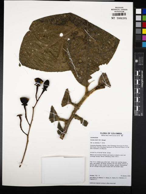
Roy Lent discovered the species in April 1967 on a steep hillside overlooking the Río Grande de Orosi. The Oklahoma botanist had a knack for scrambling into ravines that other collectors avoided. W.C. Burger and Henk van der Werff honored him when they formally described the tree in 1990. The IUCN now lists O. lentii as Near Threatened: its 72 km² area of occupancy is scattered across a dozen fragmented locations, with cattle pastures and pineapple plantations cutting off the frugivores that once connected them.
Identification
Leaves
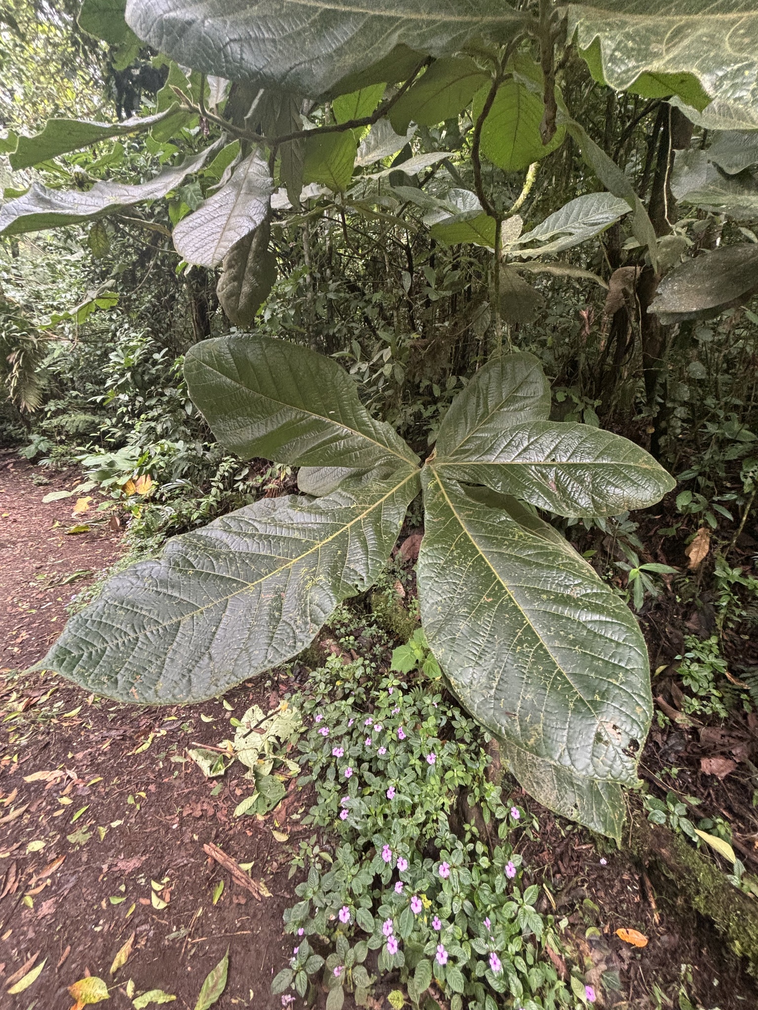
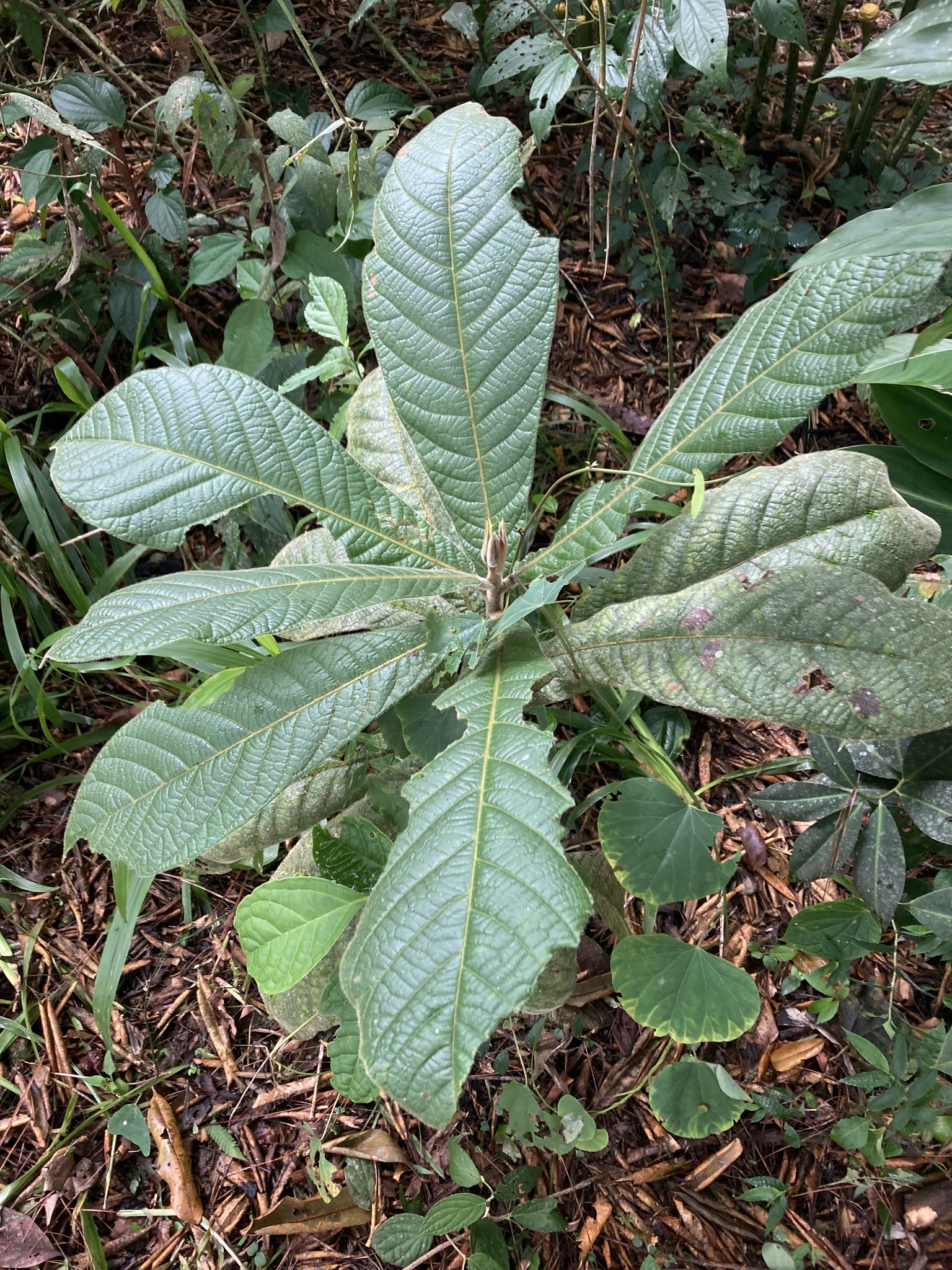
The leaves are among the largest in the genus: typically 25–35 cm long by 8–14 cm wide, with an obovate (egg-shaped, broadest above the middle) outline and a rounded tip. The blades are thin-textured (chartaceous) and carry short, stiff hairs when young, especially along the midrib (central vein). The upper surface dries pale brown, while the lower surface remains greener. Unlike many cloud-forest Lauraceae, the leaves lack domatia (small pockets housing symbiotic mites).
Flowers
Inflorescences are long-pedunculate (with stalks 3–8 cm) and sparsely branched, bearing relatively few flowers. The floral tube is lined with lustrous straight hairs that gleam under magnification. The anthers are almost sessile (lacking visible stalks) and as broad as they are long. Flowering occurs twice yearly: January through April during the dry season, and again in November before the second wet pulse.
Fruits
Fruits are among the largest in the genus: drupes 3–6 cm long and 2–3 cm in diameter, sitting on a flat or shallowly cupulate (cup-shaped) receptacle 8–25 mm across. Unlike Ocotea valeriana and O. mollifolia, which share similar floral structures, the fruits of O. lentii are not tightly clasped by the cupule. This loose fit may facilitate dispersal by toucans and guans that swallow the drupes whole and regurgitate the seeds elsewhere.
Distribution & Range
Botanists have collected O. lentii from scattered sites across Costa Rica, mostly on the Caribbean slope but also in the Golfo Dulce lowlands of the Brunca region. Records span Limón, Cartago, northern Guanacaste, and Puntarenas, including 1994 collections from Piedras Blancas National Park near the Osa Peninsula. A few older specimens from Colombia's Chocó foothills suggest the species may extend into South America, though this needs confirmation. The trees grow from near sea level (70 m) up to almost 2,000 m, an unusually broad range for a Lauraceae. Populations survive inside Barbilla, Tapantí, Piedras Blancas, Guanacaste, and La Amistad parks, but wide gaps of farmland separate them.
In the lowlands, the species grows alongside almendro (Dipteryx panamensis) and other rainforest giants. Higher up, it shares the misty slopes with tree ferns and cloud-forest magnolias. The IUCN estimates the total occupied habitat at just 72 km², fragmented across a dozen locations. Cattle pastures and pineapple plantations have cut off the forested corridors that once let seed-carrying birds and monkeys move between populations.
Wildlife Connections
Whitewater valleys on the Caribbean slope still resound with the calls of toucans, macaws, and primates that depend on O. lentii. Yellow-throated Toucans and Great Green Macaws pluck the massive drupes straight from the crown, while spider monkeys and white-faced capuchins carry the oily fruits along riparian corridors, voiding the seeds far from the parent trees. Maintaining these frugivore movements is the only way to keep the species’ scattered foothill subpopulations connected.
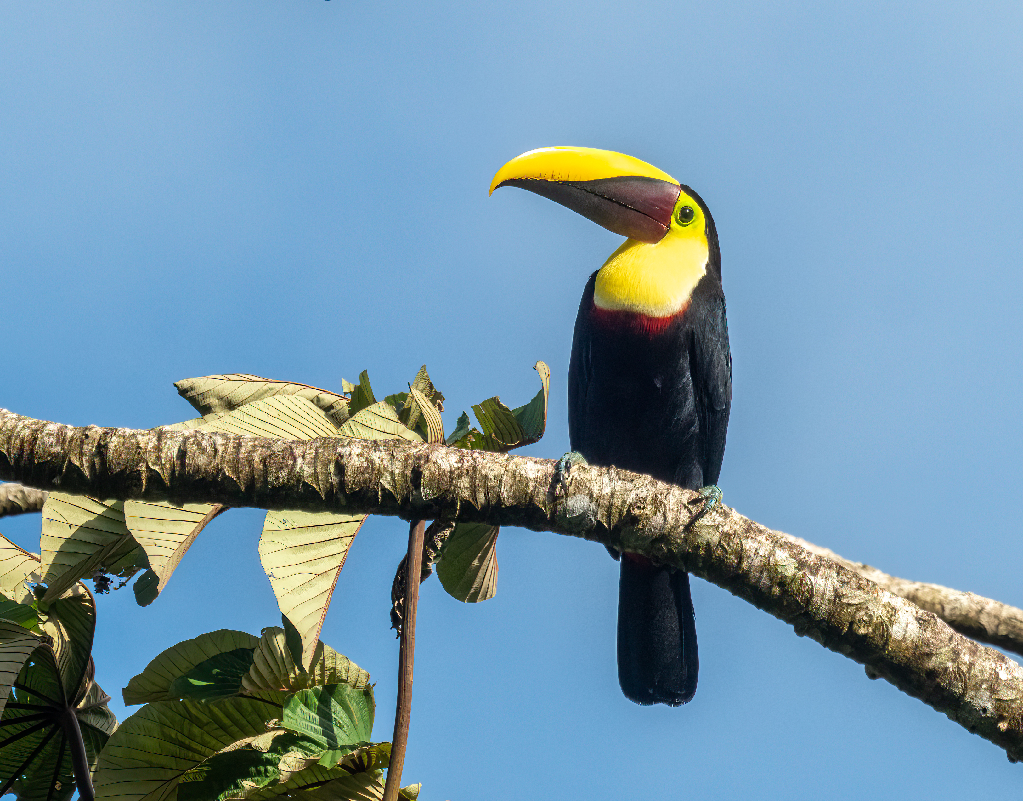
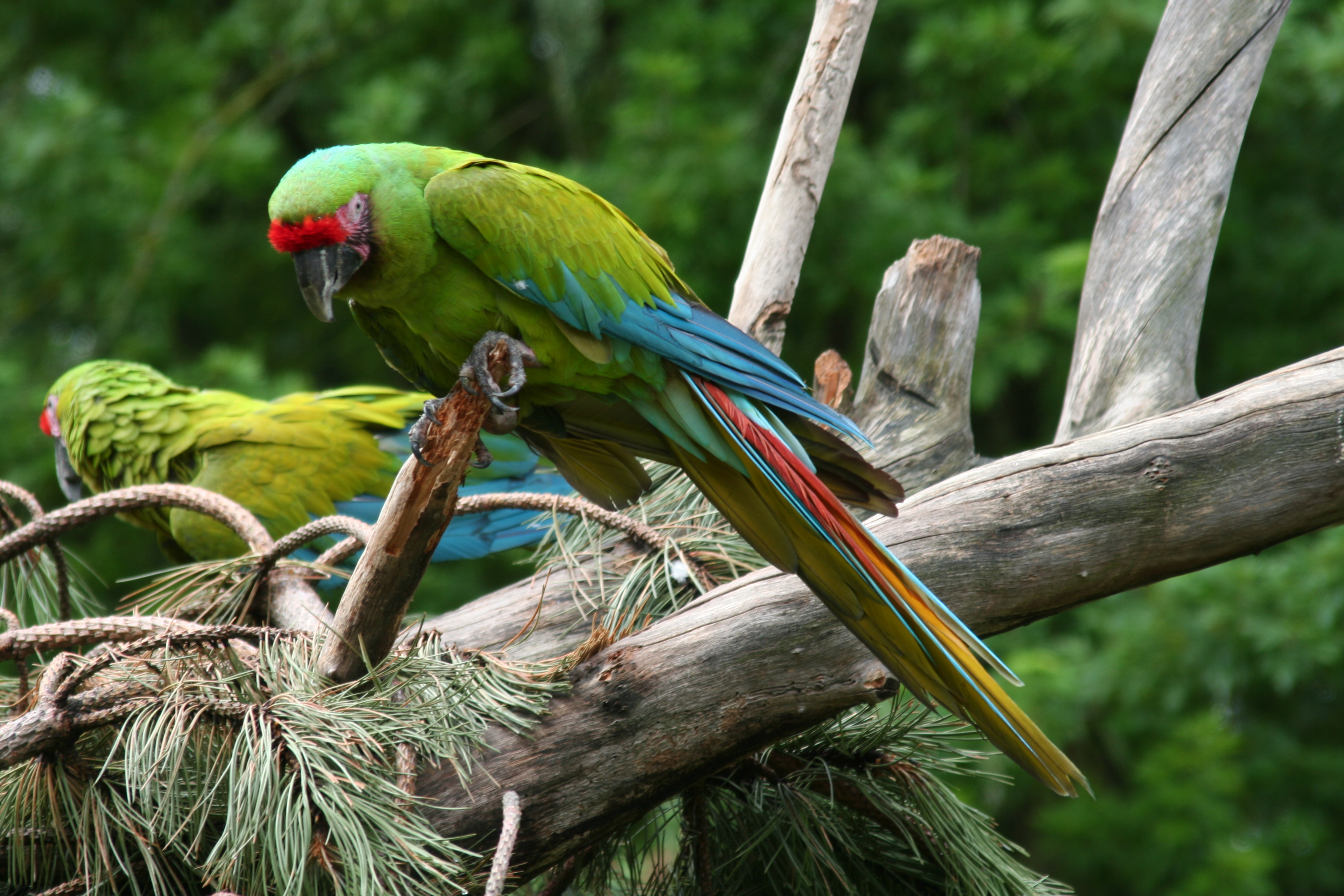
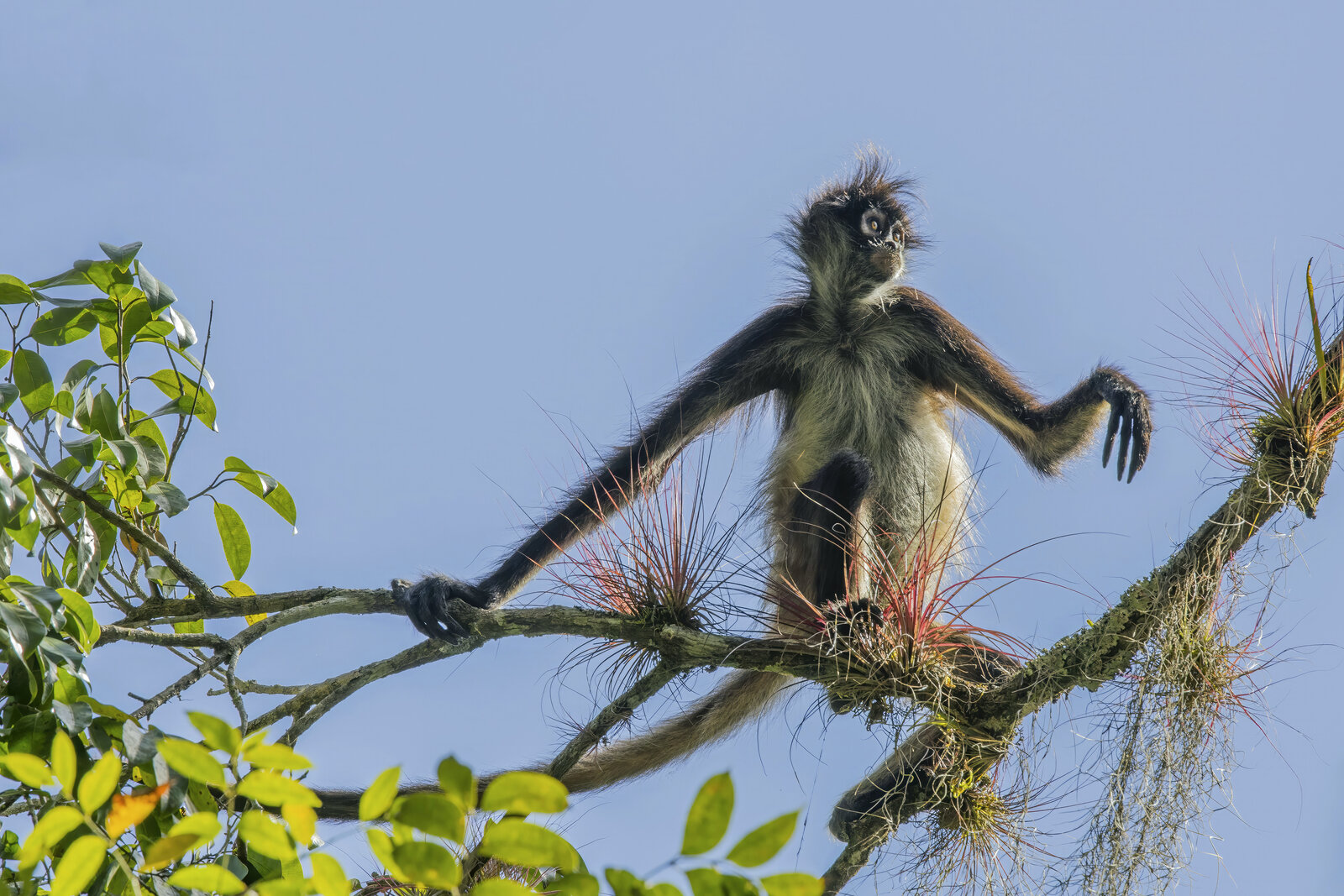
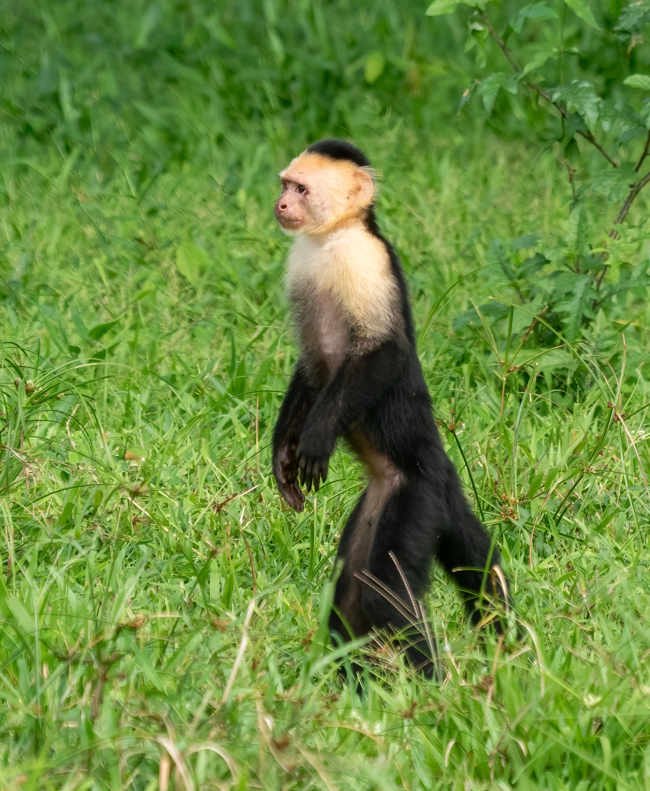
Photos (clockwise from top left): Yellow-throated Toucan (Rhododendrites via Wikimedia Commons, CC BY-SA 4.0); Great Green Macaw (Alois Staudacher via Wikimedia Commons, CC BY-SA 3.0); Geoffroy's spider monkey (Charles J. Sharp via Wikimedia Commons, CC BY-SA 4.0); white-faced capuchin (Rhododendrites via Wikimedia Commons, CC BY-SA 4.0).
The massive drupes fall squarely into the "megafaunal fruit" syndrome that ecologists associate with extinct Pleistocene dispersers. Gomphotheres, giant ground sloths, and other herbivores that vanished 10,000 years ago could swallow such fruits whole and deposit seeds far from the parent tree. With those dispersers gone, large-seeded Lauraceae now depend on the surviving megafauna: Baird's tapirs, spider monkeys, and large cracids like the Great Curassow. Research on oilbirds (Steatornis caripensis) reveals another pathway. These nocturnal frugivores specialize on lipid-rich Lauraceae, swallowing seeds up to 29 mm wide and dispersing them an average of 10 km from the source tree, with some traveling over 47 km. For O. lentii, whose loose cupules release the drupe easily, oilbird visitation in premontane caves along the Reventazón could explain how populations persist across such fragmented terrain.
Tapantí: The Wettest Cradle
The hillside where Roy Lent first collected this species lies within Tapantí–Macizo de la Muerte National Park, a 58,000-hectare reserve southeast of San José on the Atlantic-facing slopes of the Talamanca Range. The park receives 6 to 8 meters of rain annually, making it one of the wettest places on Earth. It spans five life zones, from humid premontane forest at 1,200 m to subalpine rain páramo at the continental divide, supporting 1,229 documented plant species including three miniature orchids discovered here in 2009 that are known from nowhere else.
That O. lentii thrives here and also in lowland rainforest at 100 m makes it an ecological oddity. Most Lauraceae are elevation specialists; few tolerate both the perpetual fog of Tapantí's headwaters and the seasonal droughts of the Caribbean coastal plain. This unusual breadth may reflect an ancient lineage that tracked the Talamanca orogeny upward, retaining lowland populations while colonizing newly emerged cloud-forest habitat. The Colombian vouchers, if confirmed, would extend this story across the Darién land bridge into the Chocó.
Corridors Under Siege
The scattered subpopulations of O. lentii depend on riparian corridors that are themselves under threat. The Barbilla-Destierro biological subcorridor, which links the Talamanca foothills to the Caribbean lowlands, is critical for jaguar migration across Mesoamerica. But hydroelectric development on the Reventazón River has fragmented this corridor, affecting an estimated 471 animal species including 34 at risk of extinction. Cattle pastures and pineapple plantations fill the gaps between forest patches, isolating the toucans, macaws, and primates that once moved freely between lowland and premontane stands.
In 2015, Costa Rica declared the Pacuare River protected from hydropower for 25 years, recognizing its ecological and social importance. Extending similar protection to the Reventazón and Sixaola drainages would benefit O. lentii directly, ensuring that seed dispersers can still track its scattered fruiting trees across the Caribbean slope. Without these corridors, the species' 72 km² Area of Occupancy may fragment further, leaving each subpopulation genetically stranded on its own forested island.
Taxonomic Notes
Roy W. Lent (1932–2012), a University of Oklahoma graduate, collected the type specimen in April 1967 on a hillside overlooking the Río Grande de Orosi. Between 1964 and 1971, he gathered thousands of specimens from the Talamanca foothills, often in terrain so steep that other botanists avoided it entirely. W.C. Burger and Henk van der Werff published the description in Fieldiana Botany (1990), honoring Lent's knack for finding Lauraceae in inaccessible ravines. The holotype is housed at the Field Museum in Chicago with duplicates at Missouri, Kew, and Costa Rica's INB. Lent eventually settled in Escazú, where he died in 2012.
The species belongs to a group of large-fruited Costa Rican Ocoteas that also includes O. valeriana and O. mollifolia, but differs in its loosely clasping cupule and its unusual elevational range. The Colombian vouchers from the Chocó–Valle del Cauca foothills may extend its range, but whether these represent true O. lentii or a closely related taxon remains uncertain pending molecular comparison. For now, the IUCN assessment treats the species as a Costa Rican endemic.
Conservation
Ocotea lentii is not currently logged for timber, but its habitat is threatened by expanding agriculture, smallholder cattle ranching, and tourism infrastructure. The Red List assessment recommends improved monitoring and ex situ conservation; seeds should be collected from multiple elevations to capture the species' climatic breadth. Because flowering occurs twice a year, community seed banks can stagger harvests to avoid stressing any single population.
Resources & Further Reading
Species Information
Accepted name, publication citation, and curated distribution summary maintained by Kew.
Assessment explaining the Near Threatened status, number of locations, and conservation recommendations.
Taxonomy & Nomenclature
Fieldiana Botany n.s. 23: 86. Original description with detailed morphology and distribution notes.
Regional treatment that places O. lentii within Costa Rica's Lauraceae flora.
Ecology & Seed Dispersal
PLOS ONE analysis of megafaunal fruits in the Neotropics and their dependence on extinct Pleistocene dispersers like gomphotheres and giant ground sloths.
Scientific Reports study documenting oilbird dispersal of Lauraceae seeds up to 47 km, with mean distances exceeding 10 km, far surpassing most extant frugivores.
Conservation & Biological Corridors
Overview of the 58,000-hectare park that receives 6–8 meters of annual rainfall and harbors over 1,200 plant species, including the type locality for O. lentii.
Conservation blueprint for the subcorridor linking Talamanca foothills to the Caribbean lowlands, critical for jaguar migration and seed disperser connectivity.
Background on the 25-year moratorium (2015–2040) protecting the Pacuare from hydropower development, a model for conserving Costa Rica's Caribbean rivers.