The Dictionary Maker: Leslie Holdridge and the Language of Life Zones
Before Costa Rica could save its forests, it needed to name them. A botanist spent a lifetime turning climate data into a universal language for understanding where life happens.
Stand at sea level on Costa Rica's Caribbean coast, where rain falls 4,000 millimeters a year and the temperature never drops below 24°C. You're in tropical wet forest. Drive three hours west and climb to 1,800 meters on the Continental Divide. The rain is even heavier, 5,000 millimeters annually, but the temperature has dropped to 12°C. You've entered lower montane rain forest. Keep climbing to 3,000 meters on the slopes of Chirripó. Rainfall decreases to 2,000 millimeters, and the temperature hovers around 6°C. You're now in montane rain forest, approaching the páramo. Three ecosystems, three different assemblages of species, three distinct worlds.
Before 1947, scientists lacked a rigorous, universal system to classify these differences. They had rough categories (tropical, temperate, arctic) and regional classifications that worked in one place but failed in another. What they needed was a Rosetta Stone, a way to translate climate data into predictions about vegetation, to look at three simple measurements and know what kind of life could exist there.
Leslie Holdridge gave them that language. His life zones classification system, published in a two-page paper in Science in 1947, became the dictionary for tropical ecology. It reduced the overwhelming complexity of Earth's vegetation patterns to an elegant formula: mean annual biotemperature, total annual precipitation, and the ratio between them. From these three variables, you could predict whether a given location would support rainforest or desert, cloud forest or savanna, mangrove or tundra. For a country like Costa Rica, which packs twelve distinct life zones into a territory smaller than West Virginia, Holdridge's system became the foundation for all conservation planning that followed. You cannot protect what you cannot name. Holdridge taught a generation of scientists, conservationists, and policymakers how to name what they were trying to save.
Puerto Rico to the Cinchona Missions
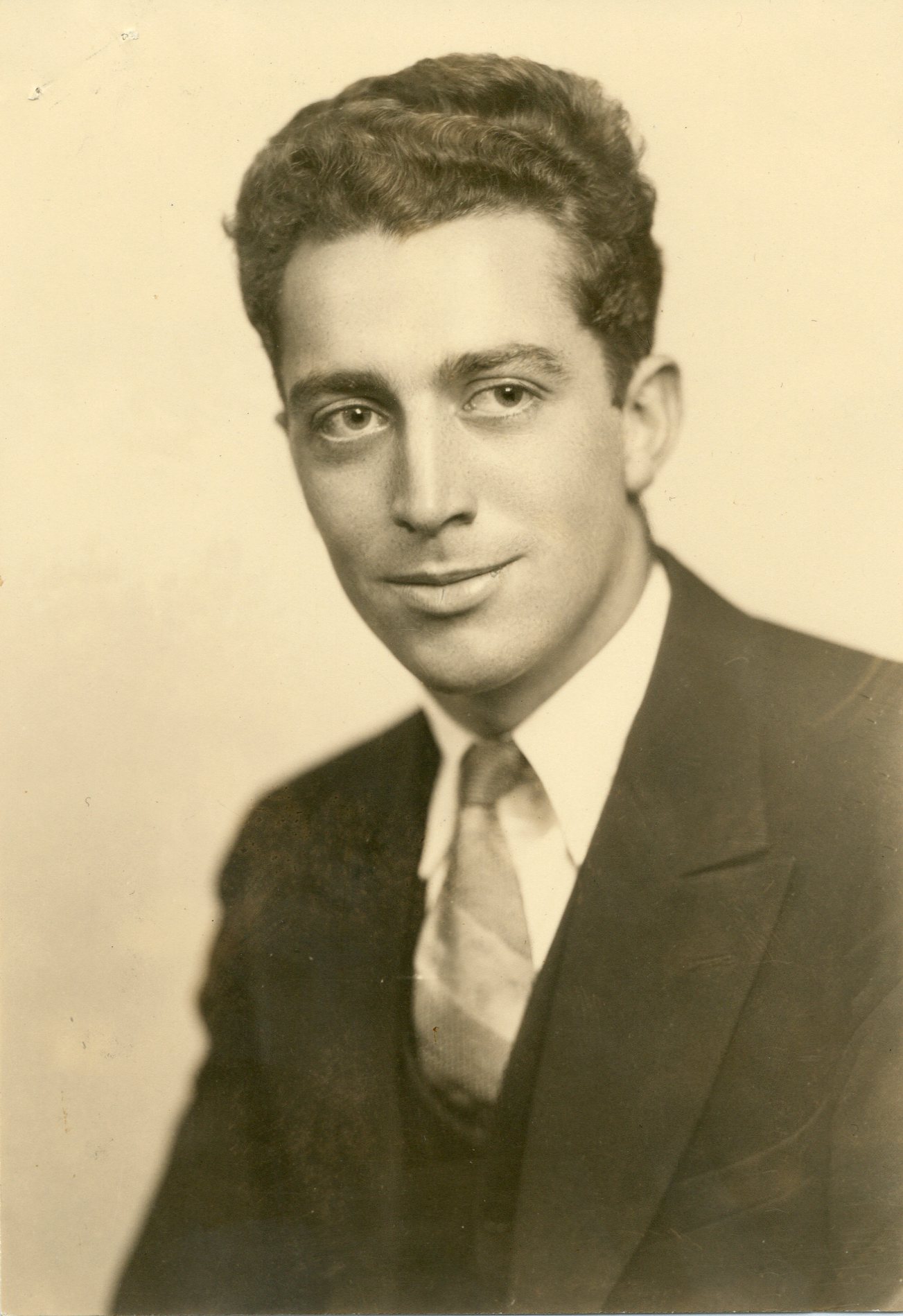
Leslie Rensselaer Holdridge was born on September 29, 1907, in Ledyard, Connecticut, a small town in the southeastern corner of the state where forests met farmland. He grew up in the kind of New England landscape that had already been transformed by three centuries of European settlement: second-growth woodlands, stone walls marking old field boundaries, a patchwork of human use and natural regeneration. It was tidy, categorizable, temperate. Nothing in his childhood hinted at the complexity he would spend his career untangling.
He studied forestry at the University of Maine, where he became a graduate fellow in botany in 1931, just as the Great Depression was tightening its grip on the country. Jobs were scarce, but the New Deal was creating opportunities for young foresters. In 1933, Holdridge found work as a reforestation foreman at Kisatchie National Forest in Louisiana, one of the many forestry projects launched to combat erosion and restore degraded landscapes. It was practical work: planting seedlings, managing crews, turning devastated land back into productive forest. The work taught him that forestry wasn't just about trees. It was about soils, water cycles, climate zones, and the interplay between human needs and ecological systems.
Two years later, in 1935, opportunity pulled him south. The U.S. Forest Service needed someone to head the planting department at Caribbean National Forest in Puerto Rico. Holdridge took the job. At 28, he left the familiar deciduous forests of North America for the Caribbean tropics. The contrast was immediate and overwhelming. Puerto Rico's forests exploded with species diversity that made New England woodlands look impoverished. A single hectare might contain a hundred tree species. Vines thick as a man's thigh climbed toward light. Epiphytes crowded every branch. Rain fell in torrents, then stopped, then fell again. The rules he'd learned in Maine and Louisiana didn't apply. Tropical forests operated on different principles, and nobody had written a clear guide to understanding them.
For six years, Holdridge worked in Puerto Rico's forests, planting experimental plots, testing which species could regenerate degraded land, studying how tropical trees responded to different conditions. He made mistakes. Years later, he would admit that planting cedro hembra (Cedrela odorata) had been his "biggest mistake" as disease and pests ravaged the plantations. But mistakes taught him what textbooks couldn't. He began to see patterns. Temperature and rainfall weren't just weather. They were fundamental constraints that determined which species could survive and which would fail. The relationship between climate and vegetation wasn't random or mystical. It was predictable, if you knew what to measure.
When World War II broke out, those pattern-recognition skills became urgently valuable. In 1942, Japan seized the Dutch East Indies, cutting off the Allies' supply of quinine, the antimalarial drug derived from cinchona tree bark. Without quinine, tropical battlefields would become death traps for soldiers vulnerable to malaria. The U.S. government launched the Cinchona Missions: expeditions to find natural cinchona sources in Latin America and establish emergency plantations. Holdridge joined the initial team that left for Colombia in October 1942. He spent the next several years moving between Colombia and Guatemala, identifying suitable locations for cinchona cultivation based on elevation, temperature, and rainfall patterns. The work was urgent and practical, but it reinforced his growing conviction that climate data could predict biological outcomes. If you knew the temperature and precipitation ranges where cinchona thrived, you could find new locations without trial and error. The principle applied to any species, any ecosystem.
The 1947 Paper
In 1946, at age 39, Holdridge enrolled at the University of Michigan to formalize the patterns he'd been observing for a decade. He completed his doctorate in botany in 1947, building on extensive field experience accumulated over fifteen years in the tropics. His dissertation research focused on the relationship between climate and vegetation in Haiti, where he'd worked during the war years. But the implications reached far beyond a single Caribbean island.
On April 4, 1947, Science published a two-page paper by Leslie R. Holdridge of the University of Michigan Department of Botany. The title was modest: "Determination of World Plant Formations From Simple Climatic Data." The approach was new. Holdridge proposed that any terrestrial ecosystem on Earth could be classified using just three climate variables. First: biotemperature, defined as mean annual temperature after eliminating readings below 0°C and above 30°C, the range where most plant growth occurs. Second: total annual precipitation. Third: the ratio of potential evapotranspiration to precipitation, which Holdridge simplified by using a factor of 58.93 times the biotemperature.
The system was empirically grounded. Holdridge hadn't constructed it from theory. He'd built it from years of field observations across Puerto Rico, Haiti, Colombia, and Guatemala, correlating climate measurements with actual vegetation types he'd encountered. The elegance lay in its simplicity. Previous classification systems required dozens of variables and subjective judgments. Holdridge's required three numbers and a chart. Plot your location's biotemperature on one axis, precipitation on another, and the evapotranspiration ratio determined your position within a hexagonal lattice. Each hexagon represented a distinct life zone: tropical wet forest, lower montane rain forest, subtropical dry forest, desert scrub, and so on through 38 global types.
Holdridge was careful to note the system's limits. These climatic variables, he acknowledged, could not perfectly predict actual plant assemblages. Geology mattered. Soil conditions mattered. Human activity mattered. The chart provided a framework, not a straitjacket. This intellectual humility, this recognition that simplification carried costs, distinguished him from scientists who mistook their models for reality.
The paper's impact was not immediate. It took two decades for the scientific community to fully appreciate what Holdridge had created. But by the 1960s and 1970s, as tropical ecology matured as a discipline and conservation planning became urgent, the life zones system became foundational. It was exactly what conservationists needed: an objective, data-driven way to identify and classify ecosystems across landscapes where traditional vegetation surveys would take years. For governments trying to establish protected areas, the system provided a scientific rationale for where boundaries should be drawn. For ecologists trying to understand biodiversity patterns, it provided a framework for predicting which species assemblages should occur where. For climate scientists beginning to model global warming's impacts, it provided a tool for forecasting how ecosystems might shift as temperatures rose.
Today, the 1947 Science paper has been cited more than 1,600 times. The Holdridge life zones system is taught in ecology courses worldwide. It has been applied to every continent except Antarctica. Climate change researchers use it to model ecosystem shifts under different warming scenarios. The Intergovernmental Panel on Climate Change incorporates life zone concepts into global assessments. Conservation planners use it to identify gaps in protected area networks. For a two-page paper, it has proven remarkably durable. The system's longevity stems from the same quality that made it useful: it distills complex ecological reality into usable form without sacrificing predictive power.
Costa Rica: Turrialba and La Selva
In January 1949, Holdridge arrived in Turrialba, Costa Rica, to begin work as chief of the Department of Natural Resources at the Inter-American Institute of Agricultural Sciences (IICA), the organization that would later become CATIE. He was 41 years old, armed with a fresh doctorate and a classification system that existed mostly on paper. Costa Rica would become his laboratory for turning theory into practice.
The timing was perfect. Costa Rica packed extraordinary ecological diversity into a small space. Within 51,000 square kilometers, the country contained twelve of Holdridge's life zones: tropical dry forest on the Pacific northwest, tropical wet forest in the Caribbean lowlands, premontane rain forest on mid-elevation slopes, lower montane rain forest in the cloud forest belt, montane rain forest approaching the highest peaks, mangrove swamps along both coasts, and all the transitional zones between them. If the life zones system could work anywhere, it could work in Costa Rica. And if it worked in Costa Rica, conservationists would have a tool for understanding what they were trying to protect.
For eleven years, Holdridge worked from the IICA campus in Turrialba, conducting research, teaching graduate students, and providing technical support to producers and institutions across Central America. He traveled constantly, visiting field sites throughout Costa Rica and neighboring countries, collecting climate data and vegetation observations to refine his system. He trained a generation of tropical foresters and ecologists, teaching them how to identify tree species in the field using vegetative characteristics rather than waiting for flowers or fruit. His dendrology courses became legendary for their rigor. Students learned to recognize families, genera, and species from bark texture, leaf venation, wood structure, and growth patterns. Holdridge believed that if you couldn't identify what you were looking at, you couldn't manage it responsibly.
But Holdridge wasn't satisfied with classification alone. He wanted to demonstrate that tropical forests could be managed sustainably, that conservation and human use weren't incompatible if you understood the ecological principles. In 1954, while still working at IICA, he purchased 620 hectares of lowland rainforest along the Sarapiquí River in northern Costa Rica's Caribbean lowlands. The property, which he named La Selva (The Jungle), would become his personal experiment in sustainable tropical forestry.
La Selva wasn't pristine when Holdridge bought it. Part of the property had been cleared for cacao cultivation, the chocolate crop that thrived in the hot, wet conditions. But Holdridge didn't clear more forest. Instead, he experimented with mixed agroforestry systems: maintaining native forest canopy while intercropping with cacao, pejibaye palms, and other useful species. He was testing a radical idea for the 1950s, that you could produce economically valuable crops without total forest clearing. His 1959 management plan proposed a thirty-year rotation that would gradually convert cleared land back to forest dominance while maintaining continuous harvest of forest products. It was sustainable forestry decades before the term became fashionable, grounded in detailed understanding of what each life zone could support.
The Tropical Science Center and Monteverde
By the early 1960s, Holdridge had concluded that Costa Rica needed an independent research organization focused on tropical conservation, something more nimble than government agencies and more locally rooted than the emerging Organization for Tropical Studies (OTS), which was being established primarily by U.S. universities. In 1962, he joined with colleagues and Costa Rican businessmen to create exactly that. The founding group included scientists Leslie Holdridge, Joseph Tosi (the geographer and forester who would become Holdridge's closest collaborator), and Robert Hunter, along with Costa Rican entrepreneurs who provided financial backing. Together they established the Tropical Science Center (Centro Científico Tropical, or TSC).
The TSC was explicitly designed as a bridge between pure science and practical application. It would conduct research in tropical biology and forestry, consult with government agencies and other organizations, actively promote conservation through lobbying and advocacy, and directly manage protected lands. It was one of Costa Rica's first environmental non-profits, established years before the national park system formally existed. The organization gave Holdridge and Tosi a platform to apply the life zones system to real conservation challenges.
That opportunity came quickly. In 1968, Costa Rica's National Planning Office requested a study of the northern region's natural resources. Holdridge and Tosi traveled to Monteverde, the remote community of Quaker settlers who had moved to Costa Rica in the 1950s seeking a peaceful place to farm. The scientists met with Hubert Mendenhall, a community leader, who took them into the primary cloud forests surrounding the settlement. What Holdridge and Tosi saw alarmed them. The forests were magnificent, representatives of lower montane rain forest and montane rain forest life zones, ecosystems becoming increasingly rare as Costa Rica's agricultural frontier expanded. But they were unprotected and vulnerable to clearing.
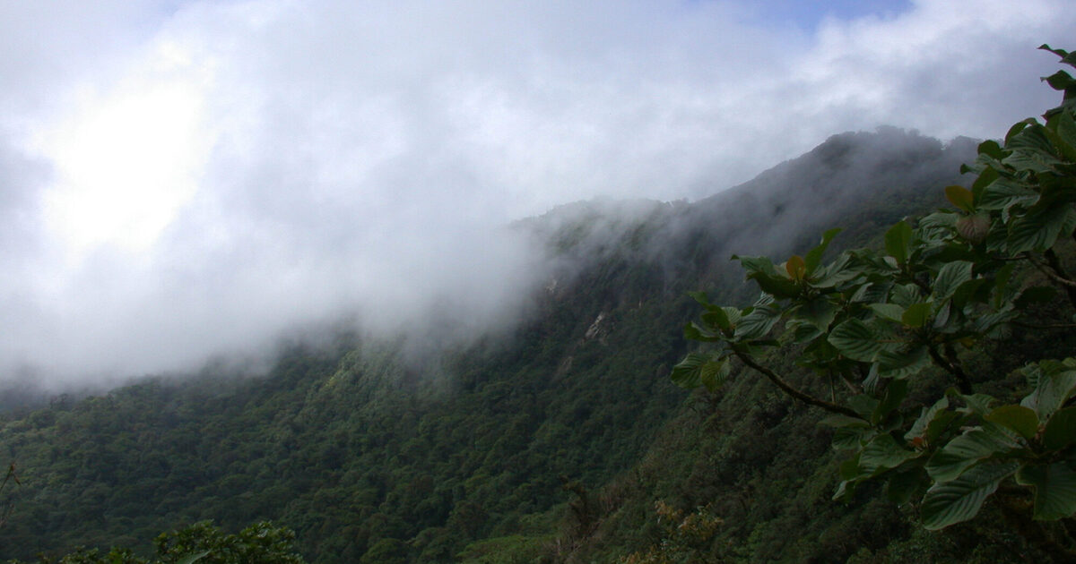
Holdridge and Tosi recommended that the Quaker community preserve the native forests to protect water sources and provide windbreaks for their farms. Their surveys had identified the area as lower montane rain forest and montane rain forest, ecosystems that were already becoming scarce in Costa Rica. These high-elevation forests intercepted moisture from trade winds, generating the water that fed springs and streams the farms depended on. Clear the forest and the hydrology would collapse. The Quakers, many of whom had conservation ethics rooted in their religious traditions, were receptive. The vision was Holdridge and Tosi's, but the hands that made it reality belonged to others. When George Powell, a graduate student studying birds, visited Monteverde in 1972 and raised funds to purchase land for protection, the Tropical Science Center became the managing organization. Powell and Wilford Guindon, a Quaker community member, transformed the scientists' recommendation into thousands of protected hectares. The Monteverde Cloud Forest Reserve now protects over 10,500 hectares because Holdridge and Tosi explained the connection between forest and water in language a farming community could understand, and local people took action.
Meanwhile, La Selva's future was being decided. Holdridge had maintained the property for fourteen years, conducting his sustainable forestry experiments while living primarily in San José where the TSC was based. But by 1968, he was 61 years old and recognized that the property's long-term value lay not in private ownership but in becoming a permanent research station. The Organization for Tropical Studies, which had been established in 1963 as a consortium of U.S. and Costa Rican universities, needed a Caribbean lowland research site to complement its other stations. Holdridge sold La Selva to OTS for $50,000.
Before completing the sale, Holdridge gave his students one final exam on the property. He led them into an isolated cacao plantation where native trees had grown into an exceptionally rich canopy above the understory crop. After the exam, the students made a recommendation: this particular patch, with its diversity of native species, should become a teaching arboretum. Holdridge agreed. He created a 3.5-hectare arboretum by enriching the old cacao grove with additional native tree species from across the property. Within months of the purchase, OTS had workers cut out the cacao to facilitate observation of the tall trees. The initial 1970 inventory recorded 650 individuals representing 111 native species. The collection would serve as an outdoor classroom for dendrology students, preserving his teaching methods in living form.
La Selva's Future and the Tree Guide
La Selva Biological Station became what Holdridge envisioned: one of the world's premier tropical research sites. Today it protects 1,600 hectares of Caribbean lowland rainforest, receives more than 300 researchers annually, and has generated thousands of scientific publications. The Holdridge Arboretum has expanded to include 929 trees representing 247 native species from 63 families. Students still use it to learn tropical dendrology, walking paths between labeled specimens that represent the diversity Holdridge spent decades studying. The arboretum functions as a living textbook, each tree a reference entry in the dictionary of tropical forest ecology.
The sale also freed Holdridge to focus entirely on the TSC and his other great project: creating a comprehensive field guide to Costa Rica's trees. Working with Luis Jorge Poveda, he published "Árboles de Costa Rica" in 1975, a guide that became a standard reference for foresters, biologists, and conservationists working in Central America. The book represented decades of field observation, thousands of specimens examined, meticulous recording of bark patterns, leaf arrangements, wood characteristics, and ecological preferences. It was dendrology in service of conservation, giving professionals and students the tools to identify and understand the trees they were working to protect. A second edition, updated with Quírico Jiménez, appeared in 1997 when Holdridge was 90 years old, testament to his continued engagement with the field he'd helped define.
But perhaps his most important later work was purely conceptual. In 1967, Holdridge published "Life Zone Ecology," an expanded treatment of his classification system that included detailed ecological profiles of each zone, management recommendations, and applications for agriculture, forestry, and conservation. The book, published by the Tropical Science Center with photographic supplements prepared by Joseph Tosi, became a standard text. It explained not just how to classify life zones but how to work within them sustainably. Each life zone, Holdridge argued, had inherent constraints and possibilities. Tropical wet forest could support certain crops but not others. Premontane rain forest had different soil formation patterns than tropical dry forest. Ignoring these differences led to agricultural failures and environmental degradation. Respecting them allowed humans to work productively within ecological limits.
The life zones system proved especially valuable for Costa Rica's emerging conservation planning. When Mario Boza and Álvaro Ugalde began creating the national park system in the early 1970s, they used Holdridge's maps to identify which life zones were underrepresented in protected areas. A 1999 gap analysis revealed that only 9 of Costa Rica's 23 life zones and transitional zones had adequate protection (defined as more than 10,000 hectares). The remaining zones, containing the majority of the country's biodiversity, had only 2% of protected area. The analysis, conducted using Holdridge's framework, demonstrated that significant portions of Costa Rica's biological diversity remained at risk and provided specific recommendations for expanding the protected area network. Without Holdridge's classification system, conducting such an analysis would have required years of vegetation surveys. With it, planners could use climate data and existing maps to identify conservation priorities quickly and objectively.
Later Years
Leslie Holdridge worked until his final years. He served as ecologist with the Tropical Science Center through 1982, and continued as a part-time professor teaching dendrology and tropical ecology. He supported research at La Selva until his death, visiting the station regularly to check on the arboretum and consult with students. He remained intellectually active, publishing papers and revising his tree guides into his nineties. When he died on June 19, 1999, at age 91 in Easton, Maryland, he left behind a legacy measured not in fame but in utility.
His life zones system has become more valuable with climate change. Researchers use it to model how ecosystems will shift as temperatures rise. Studies project that many areas will transition to different life zones within decades. Lower montane rain forest might shift upslope or disappear as suitable climate space contracts. The Intergovernmental Panel on Climate Change incorporates life zone concepts into global assessments. Restoration ecologists use it to select species for reforestation, knowing that species adapted to one life zone will fail in another.
His other legacies persist in quieter ways. The Tropical Science Center continues as one of Costa Rica's most respected environmental organizations. Monteverde attracts tens of thousands of visitors annually. La Selva has trained thousands of tropical ecologists. Students still learn tree identification in the arboretum he created, touching bark and examining leaves of specimens he selected.
Walk through Costa Rica today and you're walking through landscapes classified by Holdridge's system. The national parks protect representative samples of life zones he mapped. The reforestation projects use species selections based on his climate-vegetation relationships. When scientists say "tropical wet forest" or "lower montane rain forest," they're using categories he defined.
Last updated: November 14, 2025
References & Further Reading
Primary Scientific Publications
-
Holdridge, L.R. (1947). Determination of World Plant Formations From Simple Climatic Data. Science, 105(2727), 367-368.
The foundational two-page paper introducing the life zones classification system based on biotemperature, precipitation, and evapotranspiration ratio.
-
Holdridge, L.R. (1967). Life Zone Ecology. Tropical Science Center, San José, Costa Rica.
Comprehensive treatment of the life zones system with ecological profiles of each zone, management recommendations, and applications for agriculture and conservation. With photographic supplement by Joseph Tosi.
-
Holdridge, L.R., Poveda, L.J., & Jiménez, Q. (1997). Árboles de Costa Rica, Vol. I: Palmas, Otras Monocotiledóneas Arborescentes y Árboles con Hojas Compuestas o Lobuladas. Centro Científico Tropical.
Updated edition of the comprehensive field guide to Costa Rica's trees, a standard reference for foresters, biologists, and conservationists working in Central America.
-
Tosi, J.A., Jr. (1969). Mapa ecológico según la clasificación de zonas de vida del mundo de L.R. Holdridge, Costa Rica. Scale 1:750,000. Tropical Science Center, San José, Costa Rica.
Ecological map of Costa Rica created by Holdridge's collaborator Joseph Tosi, applying the life zones system to map the country's 12 life zones and 12 transition zones. A foundational document for Costa Rican conservation planning.
Applications in Conservation and Climate Science
-
Powell, G., Barborak, J., & Rodríguez, M. (2000). Assessing representativeness of protected natural areas in Costa Rica for conserving biodiversity: a preliminary gap analysis. Biological Conservation, 93(1), 35-41.
Gap analysis using Holdridge life zones revealing that only 9 of Costa Rica's 23 life zones had adequate protection, with 11 zones containing only 2% of protected area.
-
Birkel, C., et al. (2021). Projected climate change impacts on tropical life zones in Costa Rica. Progress in Physical Geography, 46(1), 3-26.
Uses the Holdridge framework to project how Costa Rica's life zones will shift under climate change scenarios.
-
Sánchez-Azofeifa, A., et al. (2013). An assessment of climate change impacts on the tropical forests of Central America using the Holdridge Life Zone (HLZ) land classification system. iForest, 6, 183-189.
Assessment of climate change impacts on Central American tropical forests using the Holdridge system.
-
Lugo, A.E., Brown, S.L., Dodson, R., Smith, T.S., & Shugart, H.H. (1999). The Holdridge life zones of the conterminous United States in relation to ecosystem mapping. Journal of Biogeography, 26(5), 1025-1038.
Demonstrates the continued utility of the Holdridge system for ecosystem mapping across diverse climates, applying it to map life zones across the entire United States.
Biographical Sources
-
Smith, C.H. Chrono-Biographical Sketch: Leslie R. Holdridge (1907-1999).
Chronological timeline of Holdridge's career from forestry work in Louisiana through his decades in Costa Rica.
-
Hilje, L. & Jiménez-Saa, H. (2017). Leslie R. Holdridge: Un botánico que vio muy lejos. Revista de Ciencias Ambientales, 51(2), 233-256.
Biographical essay examining Holdridge's life, scientific contributions, and lasting impact on Costa Rican conservation. Includes details of his teaching at CATIE in Turrialba and founding of the Tropical Science Center.
Institutional Resources
-
Organization for Tropical Studies: La Selva Biological Station
Official site for the research station Holdridge established in 1954 and sold to OTS in 1968, now one of the world's premier tropical research sites.
-
Organization for Tropical Studies: La Selva's Holdridge Arboretum
Information on the 3.5-hectare arboretum Holdridge created in 1968, now containing 929 trees of 247 species and accredited as a Level II Arboretum by ArbNet.
-
Tropical Science Center (Centro Científico Tropical): Our History
History of the organization Holdridge co-founded in 1962 with Joseph Tosi and Robert Hunter, now one of Costa Rica's most respected environmental organizations.
-
Monteverde Cloud Forest Reserve
Information on the reserve created in 1972 following Holdridge and Tosi's 1968 survey recommending forest protection to safeguard water sources.
Additional Context
-
Wikipedia: Holdridge Life Zones
Overview of the Holdridge life zones system, its variables, global applications, and use in climate change modeling.
-
Wikipedia: Cinchona Missions
Background on the World War II expeditions to find natural quinine sources in Latin America, in which Holdridge participated from 1942-1949.
-
Wikipedia: Leslie Holdridge
Biographical overview including education, career positions, and scientific contributions.